Road Marker Views
Description:
More Info.
Enter Road Address in your cars GPS: 985 US-12, Ortonville, MN 56278 OR Enter Geographical Coordinates in your cars GPS:
Degrees Lat Long: 45.296889, -96.432500
Latitude: 45°17’48.8″N
Longitude: 96°25’57.0″W
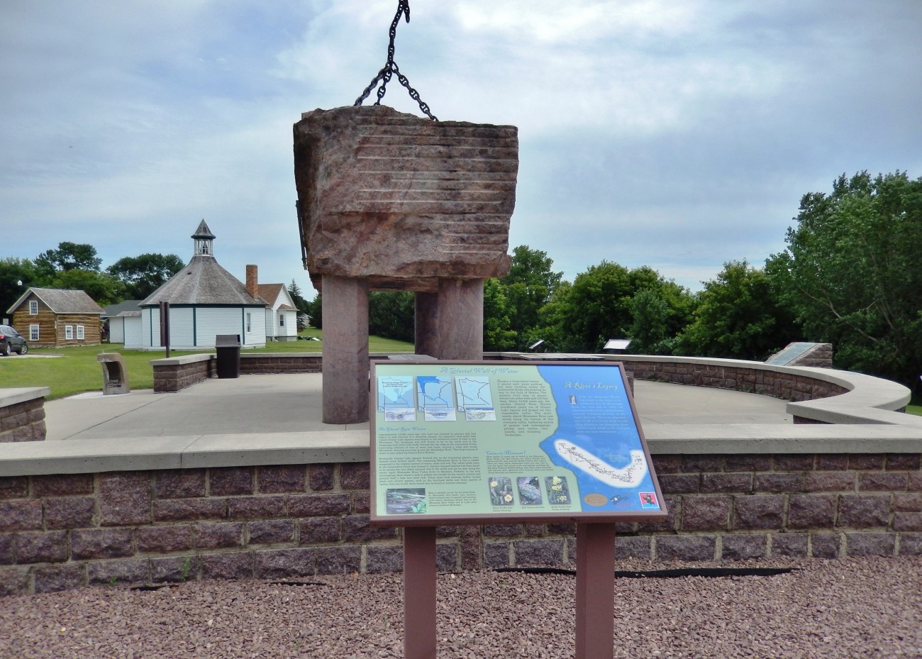
Marker is in Ortonville, Minnesota, in Big Stone County. Marker can be reached from U.S. 12, 0.1 miles west of U.S. 75, on the left when traveling west. Marker is located at the Big Stone County Welcome Center.
Marker Number:65 Marker Composition: High Pressure Laminate Signs Text on Marker:
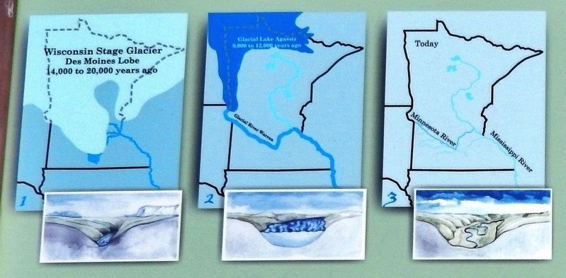
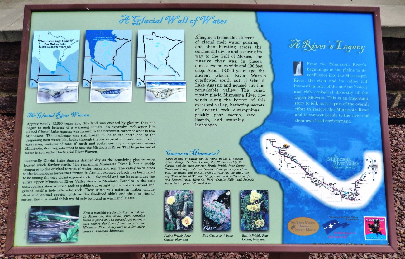
Imagine a tremendous torrent of glacial melt water pushing and then bursting across the continental divide and scouring its way to the Gulf of Mexico. The massive river was, in places, almost two miles wide and 130 feet deep. About 13,000 years ago, the ancient Glacial River Warren overflowed south out of Glacial Lake Agassiz and gouged out this remarkable valley. The quiet, mostly placid Minnesota River now winds along the bottom of this oversized valley, harboring secrets of ancient rock outcroppings, prickly pear cactus, rare lizards, and stunning landscapes.
The Glacial River Warren
Approximately 13,000 years ago, this land was encased by glaciers that had begun to melt because of a warming climate. An expansive melt-water lake named Glacial Lake Agassiz was formed in the northwest corner of what is now Minnesota. The landscape was still frozen in ice to the north and so the deepening melt-water lake broke through the low ridge at the continental divide, excavating millions of tons of earth and rocks, carving a large scar across Minnesota, draining into what is now the Mississippi River. That huge torrent of water is now called the Glacial River Warren.
Eventually Glacial Lake Agassiz drained dry as the remaining glaciers were located much farther north. The remaining Minnesota River is but a trickle compared to the original torrent of water, rocks and soil. The valley holds clues to the tremendous forces that formed it. Ancient exposed bedrock has been dated to be among the very oldest exposed rock in the world and can be seen along the entire upper Minnesota River Valley down to Mankato. Potholes in the rock outcroppings show where a rock or pebble was caught by the water’s current and ground itself a hole into solid rock. These same rock outcrops harbor unique plant and animal species, such as the five-lined skink and three species of cactus, that one would think would only be found in warmer climates.
A River’s Legacy
From the Minnesota River’s beginnings in the plains to its confluence into the Mississippi River, the river and its valley tell interesting tales of the ancient history and rich ecological diversity of the Upper Midwest. This is an important story to tell, as it is part of the overall effort to restore the Minnesota River and to connect people to the river and their own local environment.
Erected by Big Stone County Historical Society, and Federal Highway Administration.
Region: South Central/West Region Date Updated: 6-12-25 Information Needed:
- Marker Images
Condition of Marker: Good Do it Yourself Region: Alexandria and Big Stone, Minnesota River Valley Verification: Patrick Steury
Description:
More Info.
Enter Road Address in your cars GPS:
985 US-12, Ortonville, MN 56278
OR
Enter Geographical Coordinates in your cars GPS:
Degrees Lat Long: 45.296889, -96.432500
Latitude: 45°17’48.8″N
Longitude: 96°25’57.0″W
Country: Big Stone County
Where Found:
Marker is in Ortonville, Minnesota, in Big Stone County. Marker can be reached from U.S. 12, 0.1 miles west of U.S. 75, on the left when traveling west. Marker is located at the Big Stone County Welcome Center.
Marker Number: 65
Marker Composition: High Pressure Laminate Signs
Text on Marker:
Imagine a tremendous torrent of glacial melt water pushing and then bursting across the continental divide and scouring its way to the Gulf of Mexico. The massive river was, in places, almost two miles wide and 130 feet deep. About 13,000 years ago, the ancient Glacial River Warren overflowed south out of Glacial Lake Agassiz and gouged out this remarkable valley. The quiet, mostly placid Minnesota River now winds along the bottom of this oversized valley, harboring secrets of ancient rock outcroppings, prickly pear cactus, rare lizards, and stunning landscapes.
The Glacial River Warren
Approximately 13,000 years ago, this land was encased by glaciers that had begun to melt because of a warming climate. An expansive melt-water lake named Glacial Lake Agassiz was formed in the northwest corner of what is now Minnesota. The landscape was still frozen in ice to the north and so the deepening melt-water lake broke through the low ridge at the continental divide, excavating millions of tons of earth and rocks, carving a large scar across Minnesota, draining into what is now the Mississippi River. That huge torrent of water is now called the Glacial River Warren.
Eventually Glacial Lake Agassiz drained dry as the remaining glaciers were located much farther north. The remaining Minnesota River is but a trickle compared to the original torrent of water, rocks and soil. The valley holds clues to the tremendous forces that formed it. Ancient exposed bedrock has been dated to be among the very oldest exposed rock in the world and can be seen along the entire upper Minnesota River Valley down to Mankato. Potholes in the rock outcroppings show where a rock or pebble was caught by the water’s current and ground itself a hole into solid rock. These same rock outcrops harbor unique plant and animal species, such as the five-lined skink and three species of cactus, that one would think would only be found in warmer climates.
A River’s Legacy
From the Minnesota River’s beginnings in the plains to its confluence into the Mississippi River, the river and its valley tell interesting tales of the ancient history and rich ecological diversity of the Upper Midwest. This is an important story to tell, as it is part of the overall effort to restore the Minnesota River and to connect people to the river and their own local environment.
Erected by Big Stone County Historical Society, and Federal Highway Administration.
Region: South Central/West Region
Date Updated: 6-12-25 Information Needed:
- Marker Images
Condition of Marker: Good
Do it Yourself Region: Alexandria and Big Stone, Minnesota River Valley
Verification: Patrick Steury