Road Marker Views
Description:
Enter Road Address in your cars GPS: 6324 US-53, Virginia, MN 55792 OR Enter Geographical Coordinates in your cars GPS:
Degrees Lat Long 47.581594, -92.542005
Latitude: 47°34’53.7″N
Longitude: 92°32’31.2″W
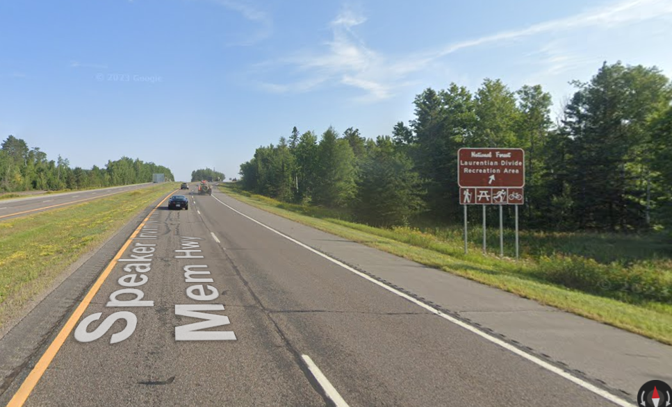
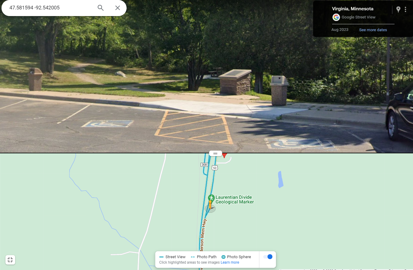
Marker is in Rochester, Minnesota, in Olmsted County. Marker is on East Silver Lake Drive, 1.8 miles north of 12th Street Southeast (U.S. 14), on the right when traveling south. Located in Silver Lake East. A well-marked pull off on U.S. Route 53 four miles north of Virginia.
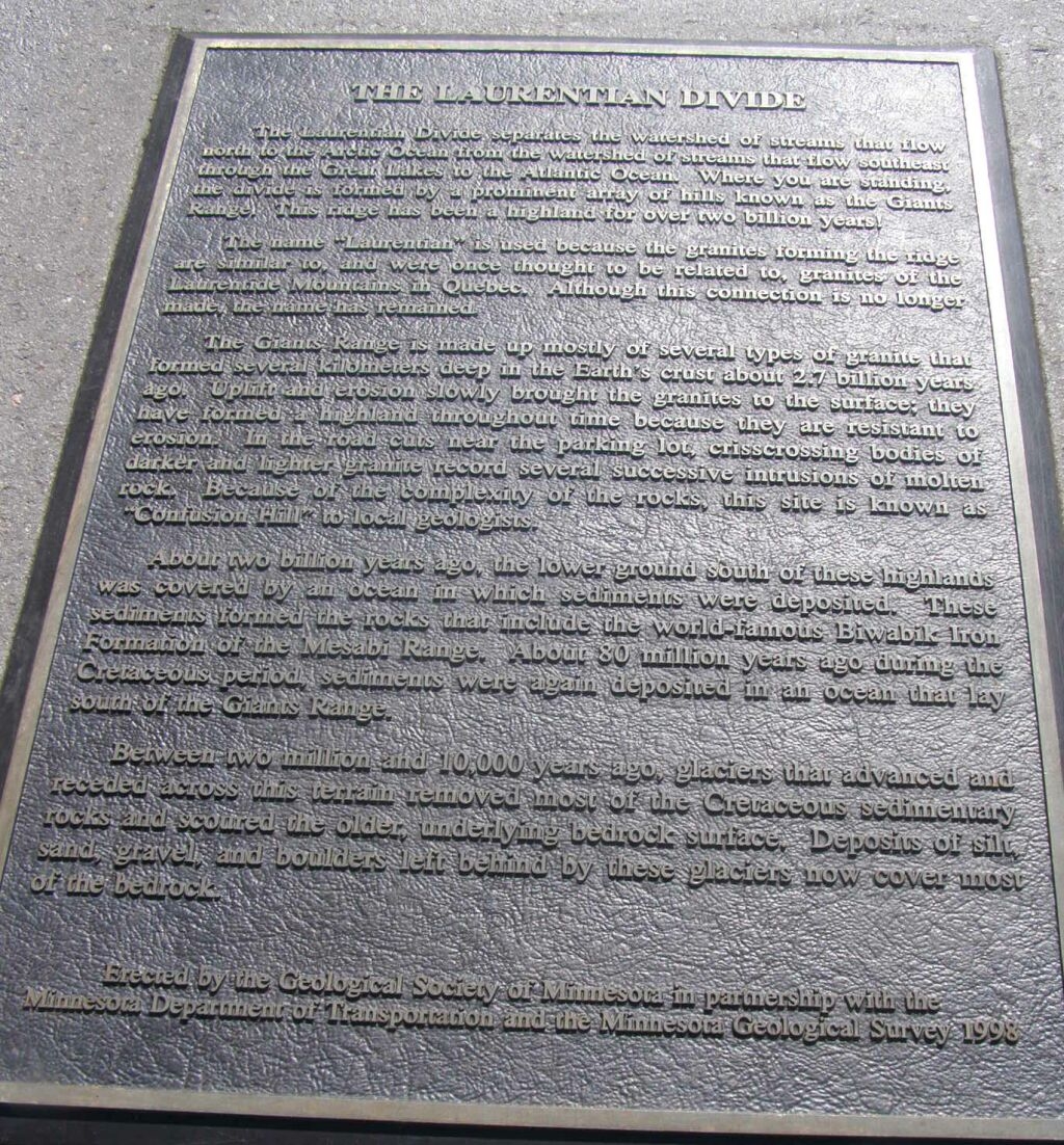
Marker Number:258 Marker Composition: Stone with Bronze plaques Text on Marker:
THE LAURENTIAN DIVIDE
The Laurentian Divide separates the watershed of streams that flow north to the Arctic Ocean from the watershed of streams that flow southeast through the Great Lakes to the Atlantic Ocean. Where you are standing, the divide is formed by a prominent array of hills known as the Giants Range. This ridge has been a high-land for over two billion years!
The name “Laurentian” is used because the granites forming the ridge are similar to, and were once thought to be related to, granites of the Laurentide Mountains in Quebec. Although this connection is no longer made, the name has remained.
The Giants Range is made up mostly of several types of granite that formed several kilometers deep in the earth’s crust about 2.7 billion years ago. Uplift and erosion slowly brought the granites to the surface; they have formed a highland throughout time because they are resistant to erosion. In the road cuts near the parking lot, crisscrossing bodies of darker and lighter granite record several successive intrusions of molten rock. Because of the complexity of the rocks, this site is known as “Confusion Hill” to local geologists.
About two billion years ago, the lower ground south of these highlands was covered by an ocean in which sediments were deposited. These sediments formed the rocks that include the world-famous Biwabik Iron Formation of the Mesabi Range. About 80 million years ago during the Cretaceous period, sediments were again deposited in an ocean that lay south of the Giants Range.
Between two million and 10,000 years ago, glaciers that advanced and receded across this terrain removed most of the Cretaceous sedimentary rocks and scoured the older, underlying bedrock surface. Deposits of silt, sand, gravel, and boulders left behind by these glaciers now cover most of the bedrock.
Erected by the Geological Society of Minnesota in partnership with the Minnesota Department of Transportation and the Minnesota Geological Survey. 1998
Region: Northeast Region Information Needed:
- Marker Images
Condition of Marker: Good Do it Yourself Region: Iron Range
Description:
Enter Road Address in your cars GPS:
6324 US-53, Virginia, MN 55792
OR
Enter Geographical Coordinates in your cars GPS:
Degrees Lat Long 47.581594, -92.542005
Latitude: 47°34’53.7″N
Longitude: 92°32’31.2″W
Country: Saint Louis County
Where Found:
Marker is in Rochester, Minnesota, in Olmsted County. Marker is on East Silver Lake Drive, 1.8 miles north of 12th Street Southeast (U.S. 14), on the right when traveling south. Located in Silver Lake East. A well-marked pull off on U.S. Route 53 four miles north of Virginia.
Marker Number: 258
Marker Composition: Stone with Bronze plaques
Text on Marker:
THE LAURENTIAN DIVIDE
The Laurentian Divide separates the watershed of streams that flow north to the Arctic Ocean from the watershed of streams that flow southeast through the Great Lakes to the Atlantic Ocean. Where you are standing, the divide is formed by a prominent array of hills known as the Giants Range. This ridge has been a high-land for over two billion years!
The name “Laurentian” is used because the granites forming the ridge are similar to, and were once thought to be related to, granites of the Laurentide Mountains in Quebec. Although this connection is no longer made, the name has remained.
The Giants Range is made up mostly of several types of granite that formed several kilometers deep in the earth’s crust about 2.7 billion years ago. Uplift and erosion slowly brought the granites to the surface; they have formed a highland throughout time because they are resistant to erosion. In the road cuts near the parking lot, crisscrossing bodies of darker and lighter granite record several successive intrusions of molten rock. Because of the complexity of the rocks, this site is known as “Confusion Hill” to local geologists.
About two billion years ago, the lower ground south of these highlands was covered by an ocean in which sediments were deposited. These sediments formed the rocks that include the world-famous Biwabik Iron Formation of the Mesabi Range. About 80 million years ago during the Cretaceous period, sediments were again deposited in an ocean that lay south of the Giants Range.
Between two million and 10,000 years ago, glaciers that advanced and receded across this terrain removed most of the Cretaceous sedimentary rocks and scoured the older, underlying bedrock surface. Deposits of silt, sand, gravel, and boulders left behind by these glaciers now cover most of the bedrock.
Erected by the Geological Society of Minnesota in partnership with the Minnesota Department of Transportation and the Minnesota Geological Survey. 1998
Region: Northeast Region
Information Needed:
- Marker Images
Condition of Marker: Good
Do it Yourself Region: Iron Range