Road Marker Views
Description:
Enter Road Address in your cars GPS: Ella Ave NW. Willmar, MN 56201 OR Enter Geographical Coordinates in your cars GPS:
Degrees Lat Long: 45.1267938,-95.0469118
Latitude: 45°07’37.0″N
Longitude: 95°02’47.0″W
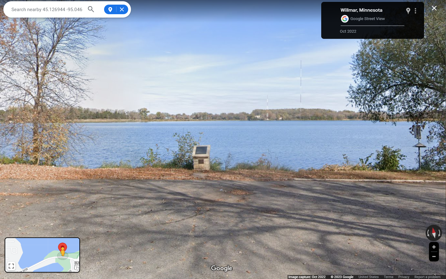
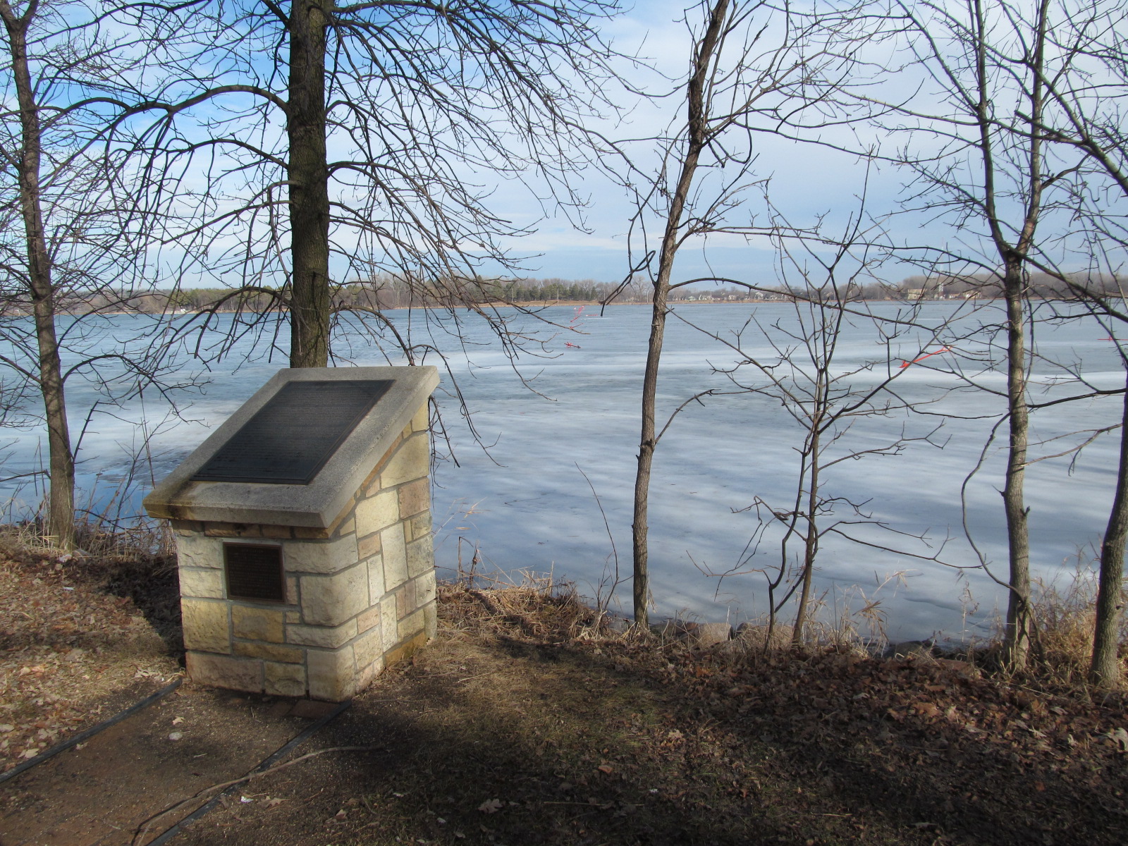
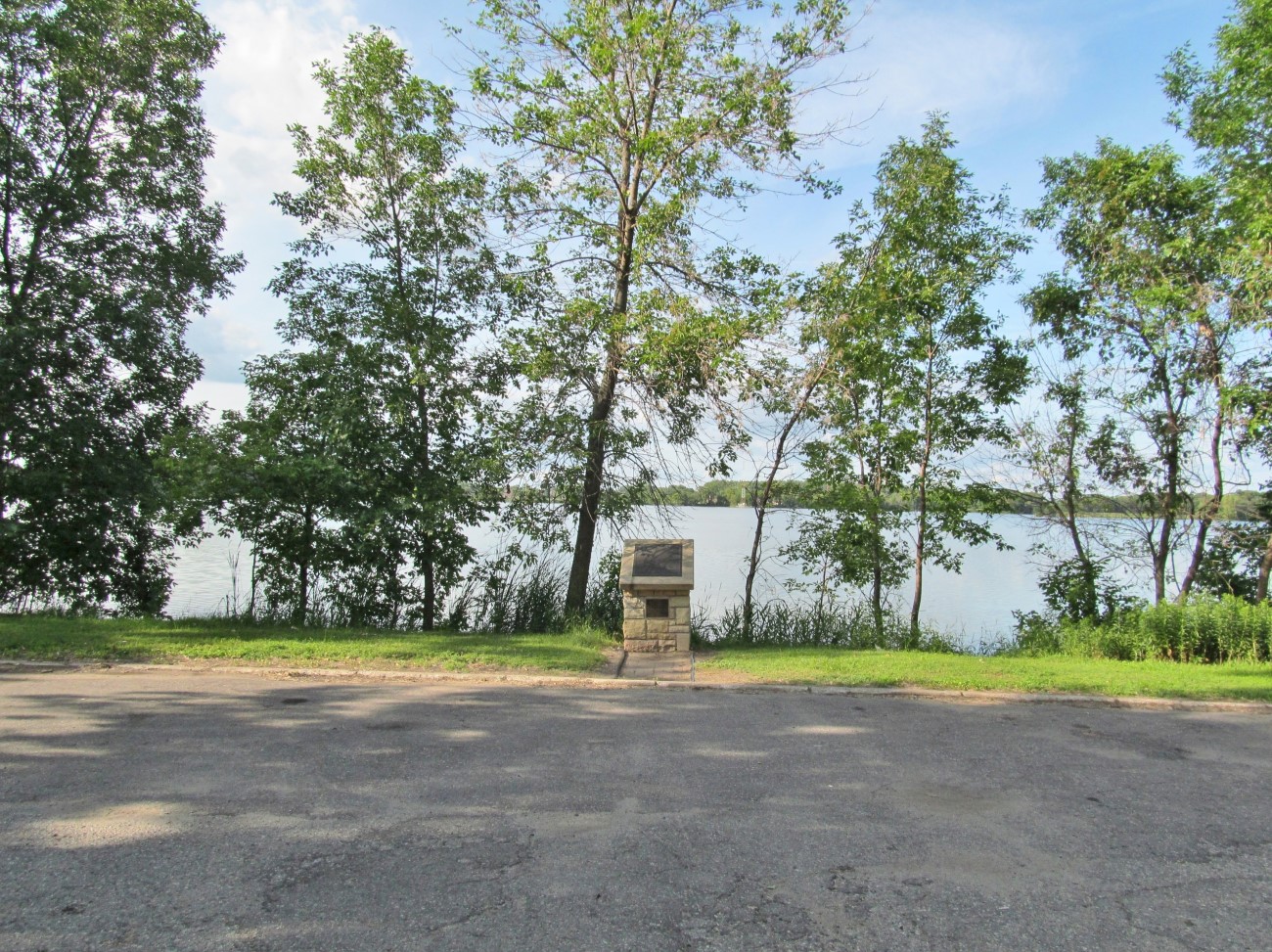
Located off U.S. highway 71 in north Willmar at a wayside rest on the south shore of Foot Lake near Ella Avenue N. W.
- Directions: From the Business Loop of Route 71, turn west onto Ella Avenue. Travel a short distance to Thompson Park. Turn into the parking lot. Marker overlooks Foot Lake.
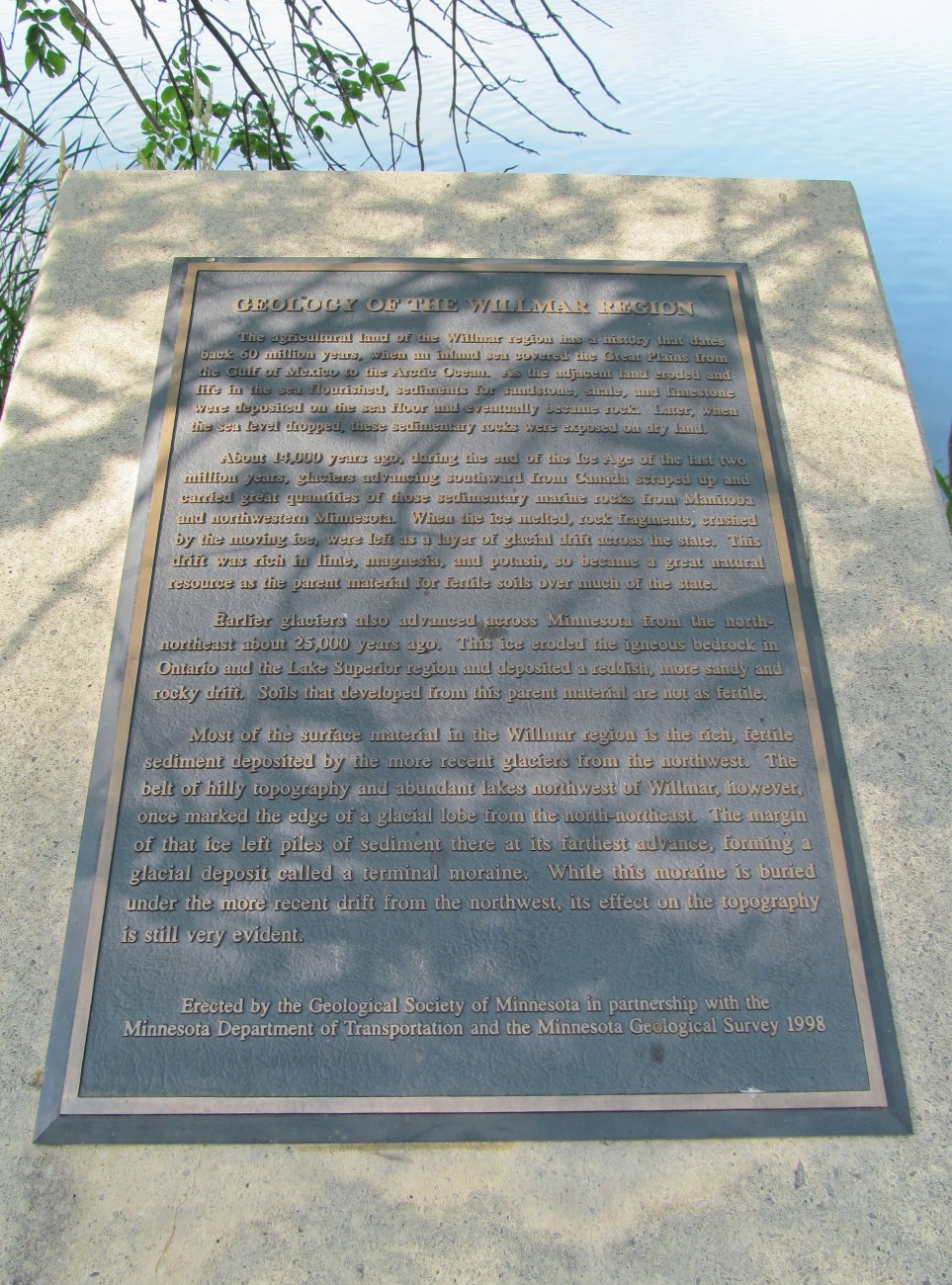
Marker Number:105 Marker Composition: Stone with Bronze plaques Text on Marker:
The agricultural land of the Willmar region has a history that dates back 60 million years, when an inland sea covered the Great Plains from the Gulf of Mexico to the Arctic Ocean. As the adjacent land eroded and life in the sea flourished, sediments for sandstone, shale, and limestone were deposited on the sea floor and eventually became rock. Later, when the sea level dropped, these sedimentary rocks were exposed on dry land.
About 14,000 years ago, during the end of the Ice Age of the last two million years, glaciers advancing southward from Canada scraped up and carried great quantities of those sedimentary marine rocks from Manitoba and northwestern Minnesota. When the ice melted, rock fragments, crushed by the moving ice, were left as a layer of glacial drift across the state. This drift was rich in lime, magnesia, and potash, so became a great natural resource as the parent material for fertile soils over much of the state.
Earlier glaciers also advanced across Minnesota from the north-northeast about 25,000 years ago. This ice eroded the igneous bedrock in Ontario and the Lake Superior region and deposited a reddish, more sandy and rocky drift. Soils that developed from this parent material are not as fertile.
Most of the surface material in the Willmar region is the rich, fertile sediment deposited by the more recent glaciers from the northwest. The belt of hilly topography and abundant lakes northwest of Willmar, however, once marked the edge of a glacial lobe from the north-northeast. The margin of that ice left piles of sediment there at its farthest advance, forming a glacial deposit called a terminal moraine. While this moraine is buried under the more recent drift from the northwest, its effect on the topography is still very evident.
Erected by the Geological Society of Minnesota in partnership with the Minnesota Department of Transportation and the Minnesota Geological Survey. 1998
Region: South Central/West Region Date Updated: 6-12-25 Information Needed:
- Marker Images
Condition of Marker: Good Do it Yourself Region: Alexandria and Big Stone Verification: Patrick Steury
Description:
Enter Road Address in your cars GPS:
Ella Ave NW. Willmar, MN 56201
OR
Enter Geographical Coordinates in your cars GPS:
Degrees Lat Long: 45.1267938,-95.0469118
Latitude: 45°07’37.0″N
Longitude: 95°02’47.0″W
Country: Kandiyohi County
Where Found:
Located off U.S. highway 71 in north Willmar at a wayside rest on the south shore of Foot Lake near Ella Avenue N. W.
- Directions: From the Business Loop of Route 71, turn west onto Ella Avenue. Travel a short distance to Thompson Park. Turn into the parking lot. Marker overlooks Foot Lake.
Marker Number: 105
Marker Composition: Stone with Bronze plaques
Text on Marker:
The agricultural land of the Willmar region has a history that dates back 60 million years, when an inland sea covered the Great Plains from the Gulf of Mexico to the Arctic Ocean. As the adjacent land eroded and life in the sea flourished, sediments for sandstone, shale, and limestone were deposited on the sea floor and eventually became rock. Later, when the sea level dropped, these sedimentary rocks were exposed on dry land.
About 14,000 years ago, during the end of the Ice Age of the last two million years, glaciers advancing southward from Canada scraped up and carried great quantities of those sedimentary marine rocks from Manitoba and northwestern Minnesota. When the ice melted, rock fragments, crushed by the moving ice, were left as a layer of glacial drift across the state. This drift was rich in lime, magnesia, and potash, so became a great natural resource as the parent material for fertile soils over much of the state.
Earlier glaciers also advanced across Minnesota from the north-northeast about 25,000 years ago. This ice eroded the igneous bedrock in Ontario and the Lake Superior region and deposited a reddish, more sandy and rocky drift. Soils that developed from this parent material are not as fertile.
Most of the surface material in the Willmar region is the rich, fertile sediment deposited by the more recent glaciers from the northwest. The belt of hilly topography and abundant lakes northwest of Willmar, however, once marked the edge of a glacial lobe from the north-northeast. The margin of that ice left piles of sediment there at its farthest advance, forming a glacial deposit called a terminal moraine. While this moraine is buried under the more recent drift from the northwest, its effect on the topography is still very evident.
Erected by the Geological Society of Minnesota in partnership with the Minnesota Department of Transportation and the Minnesota Geological Survey. 1998
Region: South Central/West Region
Date Updated: 6-12-25 Information Needed:
- Marker Images
Condition of Marker: Good
Do it Yourself Region: Alexandria and Big Stone
Verification: Patrick Steury