Road Marker Views
Description:
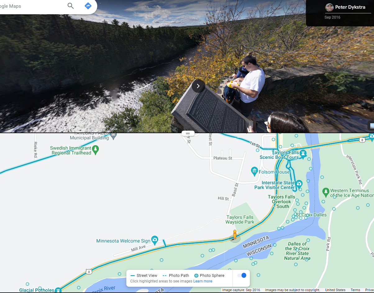
Google Maps panorama of marker.
Enter Road Address in your cars GPS: 307 Milltown Rd, Taylors Falls, MN 55084 OR Enter Geographical Coordinates in your cars GPS:
Degrees Lat Long : 45.397750, -92.655222
Latitude: 45°23’51.9″N
Longitude: 92°39’18.8″W
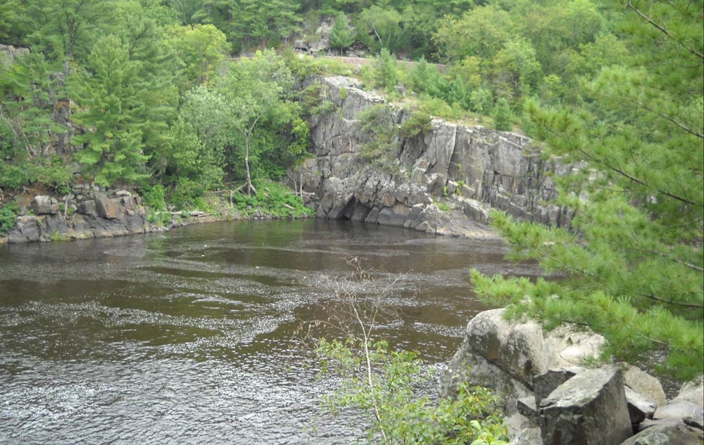
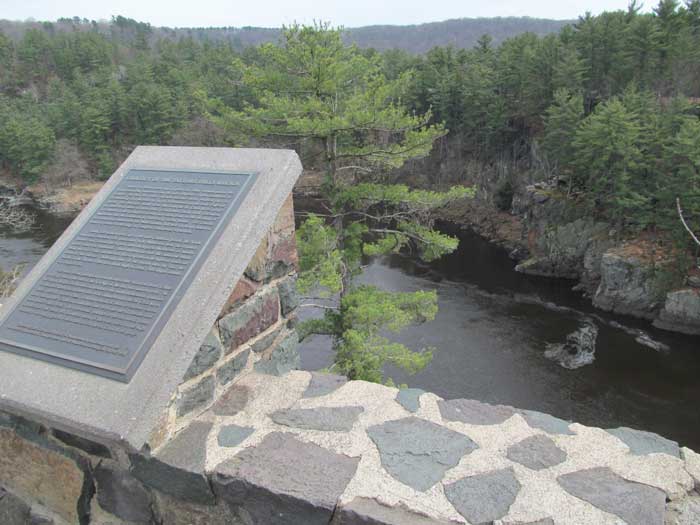
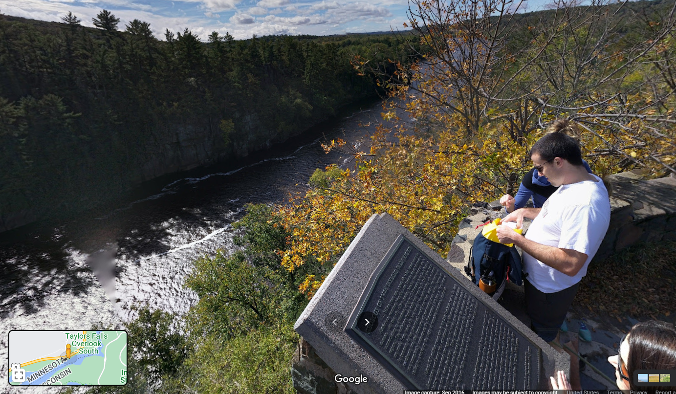
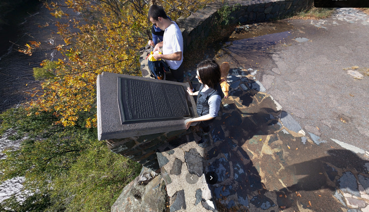
Located on U.S. highway 8 and state highway 95 in a scenic overlook .2 mile south of Taylors Falls Directions: Marker is situated on the shoulder of Route 8 just before it reaches the center of the village of Taylors Falls. Guard rails prevent access to the marker from Route 8. Access by hiking the River Trail from the Potholes parking lot up towards the top of the rock bluffs.
Marker Number:5 Marker Composition: Stone with Bronze plaques Text on Marker:
GEOLOGY OF THE TAYLORS FALLS REGION
About 1.1 billion years ago, a great rift valley formed across the North American continent from the Lake Superior region southwest to Kansas. As this rift valley opened, basaltic lavas erupted into it, accumulating to a thickness of up to 20 kilometers in the Lake Superior region. The dark-grey basalt rocks that form the St. Croix River gorge are made from these rift lava flows. Continental rifting with volcanism is common in the geological record and often leads to the breakup of continents and the formation of intervening ocean basins. For reasons not completely understood, the Midcontinent Rift here in North America failed to evolve to the stage of complete continental separation.
About 520 million years ago in the Late Cambrian period, the North American continent was positioned with Minnesota near the equator. Shallow seas covered the region, into which great thicknesses of mainly quartz sand were deposited. These deposits are now the sandstone bluffs along this river valley and the rock faces exposed on the highway road cuts south of this marker. Although most of the region then lay flat, the basalts in the Taylors Falls area stood high as rocky, cliff-ringed islands in a tropical sea.
The most recent geological event recorded here occurred about 12,000 years ago during the end of the Ice Age of the last two million years. As the last of the glaciers melted and receded to the north, tremendous quantities of sediment-laden glacial meltwaters were channeled into the St. Croix River valley. Here at Taylors Falls, a colossal torrent of abrasive currents carved down through the Cambrian sandstones and deep into the rift basalts now seen on the valley floor. The spectacular potholes in the lava rock, found in Interstate Park about 0.4 kilometer north of this site, attest to the high velocity of the raging glacial waters that carved the St. Croix River gorge.
Erected by the Geological Society of Minnesota in partnership with the Minnesota Department of Transportation, the Minnesota Geological Survey, and the Minnesota Department of Natural Resources. 1998
Region: Metro Region Date Updated: 6-12-25 Information Needed:
- Marker Images
Condition of Marker: Good Do it Yourself Region: St. Croix River Valley Verification: Patrick Steury
Description:
Google Maps panorama of marker.
Enter Road Address in your cars GPS:
307 Milltown Rd, Taylors Falls, MN 55084
OR
Enter Geographical Coordinates in your cars GPS:
Degrees Lat Long : 45.397750, -92.655222
Latitude: 45°23’51.9″N
Longitude: 92°39’18.8″W
Country: Chisago County
Where Found:
Located on U.S. highway 8 and state highway 95 in a scenic overlook .2 mile south of Taylors Falls Directions: Marker is situated on the shoulder of Route 8 just before it reaches the center of the village of Taylors Falls. Guard rails prevent access to the marker from Route 8. Access by hiking the River Trail from the Potholes parking lot up towards the top of the rock bluffs.
Marker Number: 5
Marker Composition: Stone with Bronze plaques
Text on Marker:
GEOLOGY OF THE TAYLORS FALLS REGION
About 1.1 billion years ago, a great rift valley formed across the North American continent from the Lake Superior region southwest to Kansas. As this rift valley opened, basaltic lavas erupted into it, accumulating to a thickness of up to 20 kilometers in the Lake Superior region. The dark-grey basalt rocks that form the St. Croix River gorge are made from these rift lava flows. Continental rifting with volcanism is common in the geological record and often leads to the breakup of continents and the formation of intervening ocean basins. For reasons not completely understood, the Midcontinent Rift here in North America failed to evolve to the stage of complete continental separation.
About 520 million years ago in the Late Cambrian period, the North American continent was positioned with Minnesota near the equator. Shallow seas covered the region, into which great thicknesses of mainly quartz sand were deposited. These deposits are now the sandstone bluffs along this river valley and the rock faces exposed on the highway road cuts south of this marker. Although most of the region then lay flat, the basalts in the Taylors Falls area stood high as rocky, cliff-ringed islands in a tropical sea.
The most recent geological event recorded here occurred about 12,000 years ago during the end of the Ice Age of the last two million years. As the last of the glaciers melted and receded to the north, tremendous quantities of sediment-laden glacial meltwaters were channeled into the St. Croix River valley. Here at Taylors Falls, a colossal torrent of abrasive currents carved down through the Cambrian sandstones and deep into the rift basalts now seen on the valley floor. The spectacular potholes in the lava rock, found in Interstate Park about 0.4 kilometer north of this site, attest to the high velocity of the raging glacial waters that carved the St. Croix River gorge.
Erected by the Geological Society of Minnesota in partnership with the Minnesota Department of Transportation, the Minnesota Geological Survey, and the Minnesota Department of Natural Resources. 1998
Region: Metro Region
Date Updated: 6-12-25 Information Needed:
- Marker Images
Condition of Marker: Good
Do it Yourself Region: St. Croix River Valley
Verification: Patrick Steury