Road Marker Views
Description:
Enter Road Address in your cars GPS: Babcock Memorial Park, Elk River, MN 55330 OR Enter Geographical Coordinates in your cars GPS:
Degrees Minutes Lat Long: 45.293611, -93.559444
Latitude: 45°17’37.0″N
Longitude: 93°33’34.0″W
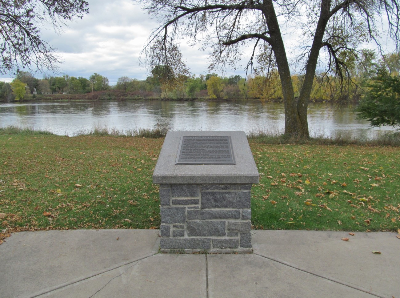
Stolen. Please contact Elk River Police with any information.
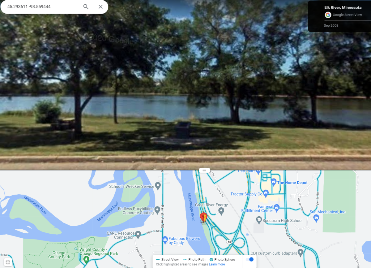
Located off U.S. highway 10 just north of its junction with U.S. highway 169 in a wayside park on the Mississippi River
Driving directions: From I-94, take the Elk River exit onto route 101 and go north. As soon as you cross the bridge over the Mississippi River, take the exit to get onto Route 10 west. Get in the left lane and follow signs for the boat launch. Turn left to cross the highway and drive down the road towards the boat launch. Marker is in the first picnic area to the right.
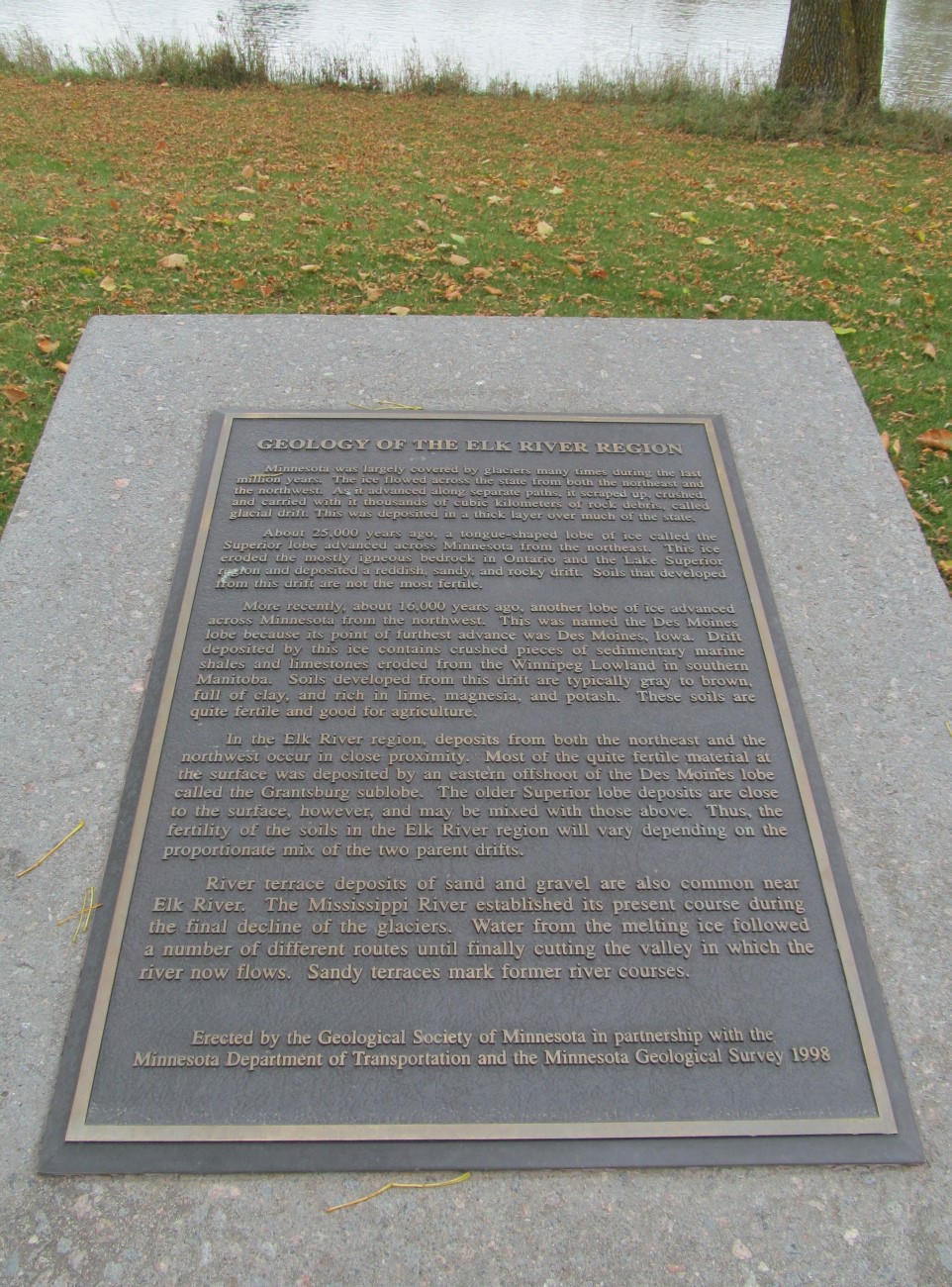
Marker Number:328 Marker Composition: Cast Bronze on a post Text on Marker:
GEOLOGY OF THE ELK RIVER REGION
Minnesota was largely covered by glaciers many times during the last million years. The ice flowed across the state from both the northeast and the northwest. As it advanced along separate paths, it scraped up, crushed, and carried with it thousands of cubic kilometers of rock debris, called glacial drift. This was deposited in a thick layer over much of the state.
About 25,000 years ago, a tongue-shaped lobe of ice called the Superior lobe advanced across Minnesota from the northeast. This ice eroded the mostly igneous bedrock in Ontario and the Lake Superior region and deposited a reddish, sandy, and rocky drift. Soils that developed from this drift are not the most fertile.
More recently, about 16,000 years ago, another lobe of ice advanced across Minnesota from the north-west. This was named the Des Moines lobe because its point of furthest advance was Des Moines, Iowa. Drift deposited by this ice contains crushed pieces of sedimentary marine shales and limestones eroded from the Winnipeg Lowland in southern Manitoba. Soils developed from this drift are typically gray to brown, full of clay, and rich in lime, magnesia, and potash. These soils are quite fertile and good for agriculture. In the Elk River region, deposits from both the northeast and the northwest occur in close proximity. Most of the quite fertile material at the surface was de-posited by an eastern offshoot of the Des Moines lobe called the Grantsburg sub lobe. The older Superior lobe deposits are close to the surface, however, and may be mixed with those above. Thus, the fertility of the soils in the Elk River region will vary depending on the proportionate mix of the two parent drifts.
River terrace deposits of sand and gravel are also common near Elk River. The Mississippi River established its present course during the final decline of the glaciers. Water from the melting ice followed a number of different routes until finally cutting the valley in which the river now flows. Sandy terraces mark former river courses.
Erected by the Geological Society of Minnesota in partnership with the Minnesota Department of Transportation and the Minnesota Geological Survey. 1998
Region: North Central/West Region Date Updated: 6-12-25 Information Needed:
- Marker Images
Condition of Marker: Good Do it Yourself Region: Metro Area Verification: Patrick Steury
Description:
Enter Road Address in your cars GPS:
Babcock Memorial Park, Elk River, MN 55330
OR
Enter Geographical Coordinates in your cars GPS:
Degrees Minutes Lat Long: 45.293611, -93.559444
Latitude: 45°17’37.0″N
Longitude: 93°33’34.0″W
Country: Sherburne County
Where Found:
Stolen. Please contact Elk River Police with any information.
Located off U.S. highway 10 just north of its junction with U.S. highway 169 in a wayside park on the Mississippi River
Driving directions: From I-94, take the Elk River exit onto route 101 and go north. As soon as you cross the bridge over the Mississippi River, take the exit to get onto Route 10 west. Get in the left lane and follow signs for the boat launch. Turn left to cross the highway and drive down the road towards the boat launch. Marker is in the first picnic area to the right.
Marker Number: 328
Marker Composition: Cast Bronze on a post
Text on Marker:
GEOLOGY OF THE ELK RIVER REGION
Minnesota was largely covered by glaciers many times during the last million years. The ice flowed across the state from both the northeast and the northwest. As it advanced along separate paths, it scraped up, crushed, and carried with it thousands of cubic kilometers of rock debris, called glacial drift. This was deposited in a thick layer over much of the state.
About 25,000 years ago, a tongue-shaped lobe of ice called the Superior lobe advanced across Minnesota from the northeast. This ice eroded the mostly igneous bedrock in Ontario and the Lake Superior region and deposited a reddish, sandy, and rocky drift. Soils that developed from this drift are not the most fertile.
More recently, about 16,000 years ago, another lobe of ice advanced across Minnesota from the north-west. This was named the Des Moines lobe because its point of furthest advance was Des Moines, Iowa. Drift deposited by this ice contains crushed pieces of sedimentary marine shales and limestones eroded from the Winnipeg Lowland in southern Manitoba. Soils developed from this drift are typically gray to brown, full of clay, and rich in lime, magnesia, and potash. These soils are quite fertile and good for agriculture. In the Elk River region, deposits from both the northeast and the northwest occur in close proximity. Most of the quite fertile material at the surface was de-posited by an eastern offshoot of the Des Moines lobe called the Grantsburg sub lobe. The older Superior lobe deposits are close to the surface, however, and may be mixed with those above. Thus, the fertility of the soils in the Elk River region will vary depending on the proportionate mix of the two parent drifts.
River terrace deposits of sand and gravel are also common near Elk River. The Mississippi River established its present course during the final decline of the glaciers. Water from the melting ice followed a number of different routes until finally cutting the valley in which the river now flows. Sandy terraces mark former river courses.
Erected by the Geological Society of Minnesota in partnership with the Minnesota Department of Transportation and the Minnesota Geological Survey. 1998
Region: North Central/West Region
Date Updated: 6-12-25 Information Needed:
- Marker Images
Condition of Marker: Good
Do it Yourself Region: Metro Area
Verification: Patrick Steury