Road Marker Views
Description:
Enter Road Address in your cars GPS: E Silver Lake Dr, Rochester, MN 55906 OR Enter Geographical Coordinates in your cars GPS:
Degrees Lat Long44.033167, -92.454667
Latitude: 44°01’59.4″N
Longitude: 92°27’16.8″W
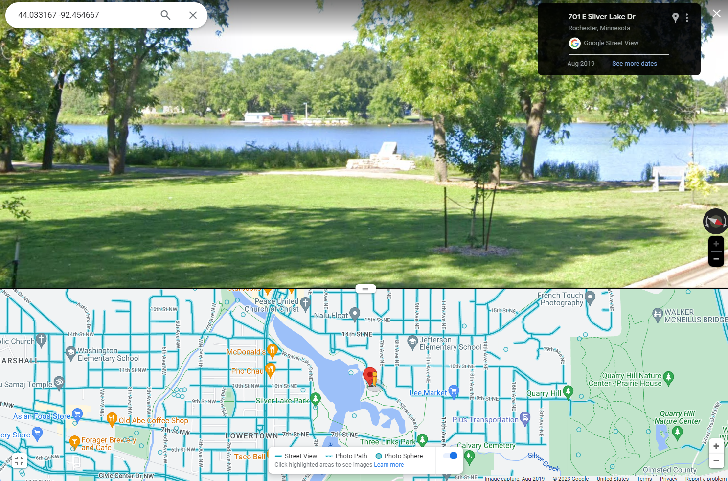
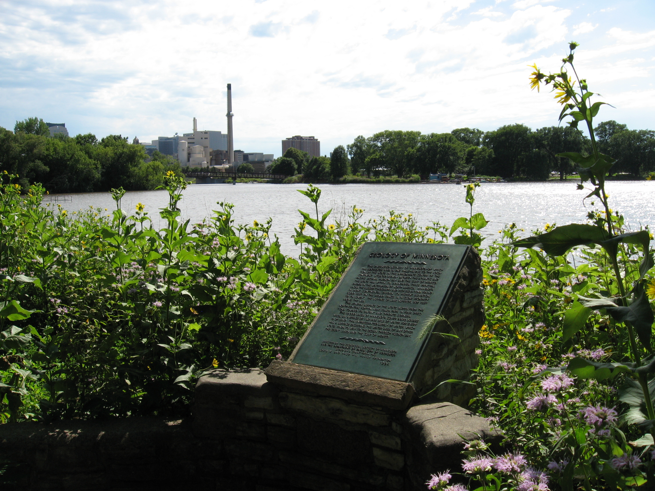
Marker is in Rochester, Minnesota, in Olmsted County. Marker is on East Silver Lake Drive, 1.8 miles north of 12th Street Southeast (U.S. 14), on the right when traveling south. Located in Silver Lake East.
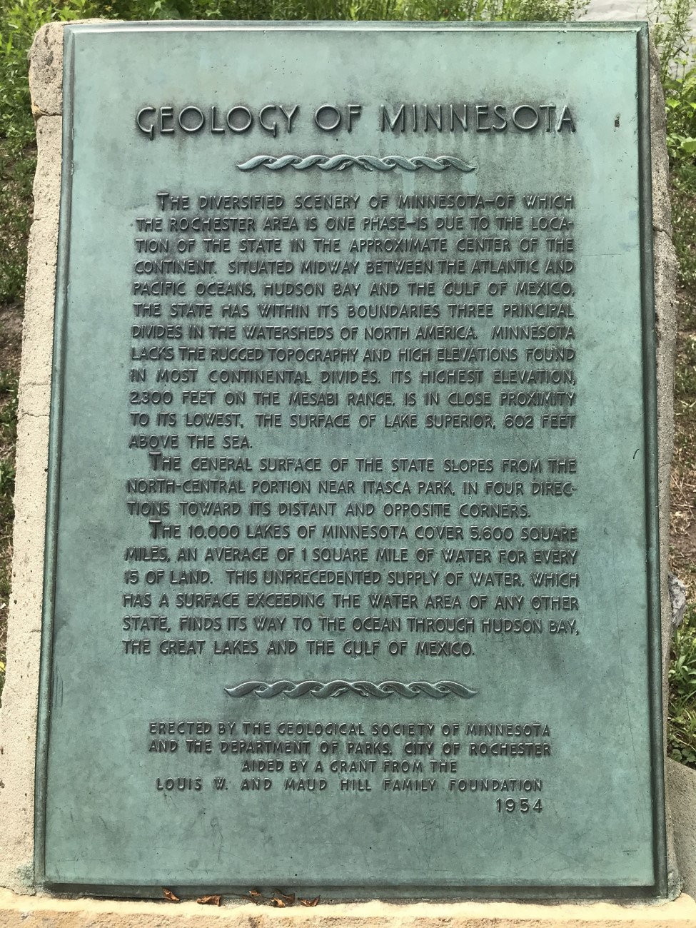
Marker Number:147 Marker Composition: Stone with Bronze plaques Text on Marker:
GEOLOGY OF MINNESOTA
The diversified scenery of Minnesota—of which the Rochester area is one phase—is due to the location of the state in the approximate center of the continent. Situated midway between the Atlantic and Pacific oceans, Hudson Bay and the Gulf of Mexico, the state has within its boundaries three principal divides in the watersheds of North America. Minnesota lacks the rugged topography and high elevations found in most continental divides. Its highest elevation, 2,300 feet on the Mesabi Range, is in close proximity to its lowest, the surface of Lake Superior, 602 feet above the sea.
The general surface of the state slopes from the north-central portion near Itasca Park, in four directions toward its distant and opposite corners.
The 10,000 lakes of Minnesota cover 5,600 square miles, an average of 1 square mile of water for every 15 of land. This unprecedented supply of water, which has a surface exceeding the water area of any other state, finds its way to the ocean through Hudson Bay, the Great Lakes and the Gulf of Mexico.
Erected by the Geological Society of Minnesota and the Department of Parks, City of Rochester aided by a grant from the Louis W. and Maud Hill Family Foundation. 1954
Region: Southeastern Region Date Updated: 6-12-25 Information Needed:
- Marker Images
Condition of Marker: Good Do it Yourself Region: Karst Country – Southeast Corner Verification: Patrick Steury
Description:
Enter Road Address in your cars GPS:
E Silver Lake Dr, Rochester, MN 55906
OR
Enter Geographical Coordinates in your cars GPS:
Degrees Lat Long44.033167, -92.454667
Latitude: 44°01’59.4″N
Longitude: 92°27’16.8″W
Country: Olmsted County
Where Found:
Marker is in Rochester, Minnesota, in Olmsted County. Marker is on East Silver Lake Drive, 1.8 miles north of 12th Street Southeast (U.S. 14), on the right when traveling south. Located in Silver Lake East.
Marker Number: 147
Marker Composition: Stone with Bronze plaques
Text on Marker:
GEOLOGY OF MINNESOTA
The diversified scenery of Minnesota—of which the Rochester area is one phase—is due to the location of the state in the approximate center of the continent. Situated midway between the Atlantic and Pacific oceans, Hudson Bay and the Gulf of Mexico, the state has within its boundaries three principal divides in the watersheds of North America. Minnesota lacks the rugged topography and high elevations found in most continental divides. Its highest elevation, 2,300 feet on the Mesabi Range, is in close proximity to its lowest, the surface of Lake Superior, 602 feet above the sea.
The general surface of the state slopes from the north-central portion near Itasca Park, in four directions toward its distant and opposite corners.
The 10,000 lakes of Minnesota cover 5,600 square miles, an average of 1 square mile of water for every 15 of land. This unprecedented supply of water, which has a surface exceeding the water area of any other state, finds its way to the ocean through Hudson Bay, the Great Lakes and the Gulf of Mexico.
Erected by the Geological Society of Minnesota and the Department of Parks, City of Rochester aided by a grant from the Louis W. and Maud Hill Family Foundation. 1954
Region: Southeastern Region
Date Updated: 6-12-25 Information Needed:
- Marker Images
Condition of Marker: Good
Do it Yourself Region: Karst Country – Southeast Corner
Verification: Patrick Steury