Road Marker Views
Description:
GEOLOGY OF LAKE MINNETONKA Excelsior
Enter Road Address in your cars GPS: 2 Water St, Excelsior, MN 55331 OR Enter Geographical Coordinates in your cars GPS:
Degrees Lat Long : 44.904528, -93.565306
Latitude: 44°54’16.3″N
Longitude: 93°33’55.1″W
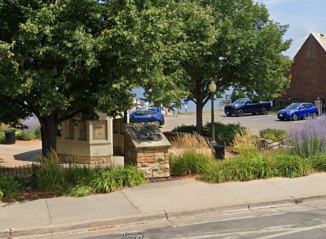
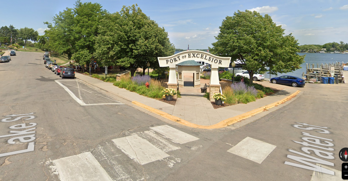
Marker is in Excelsior, Minnesota, in Hennepin County. Marker is at the intersection of Lake Street and Water Street, on the right when traveling north on Lake Street. Marker is at the Port of Excelsior.
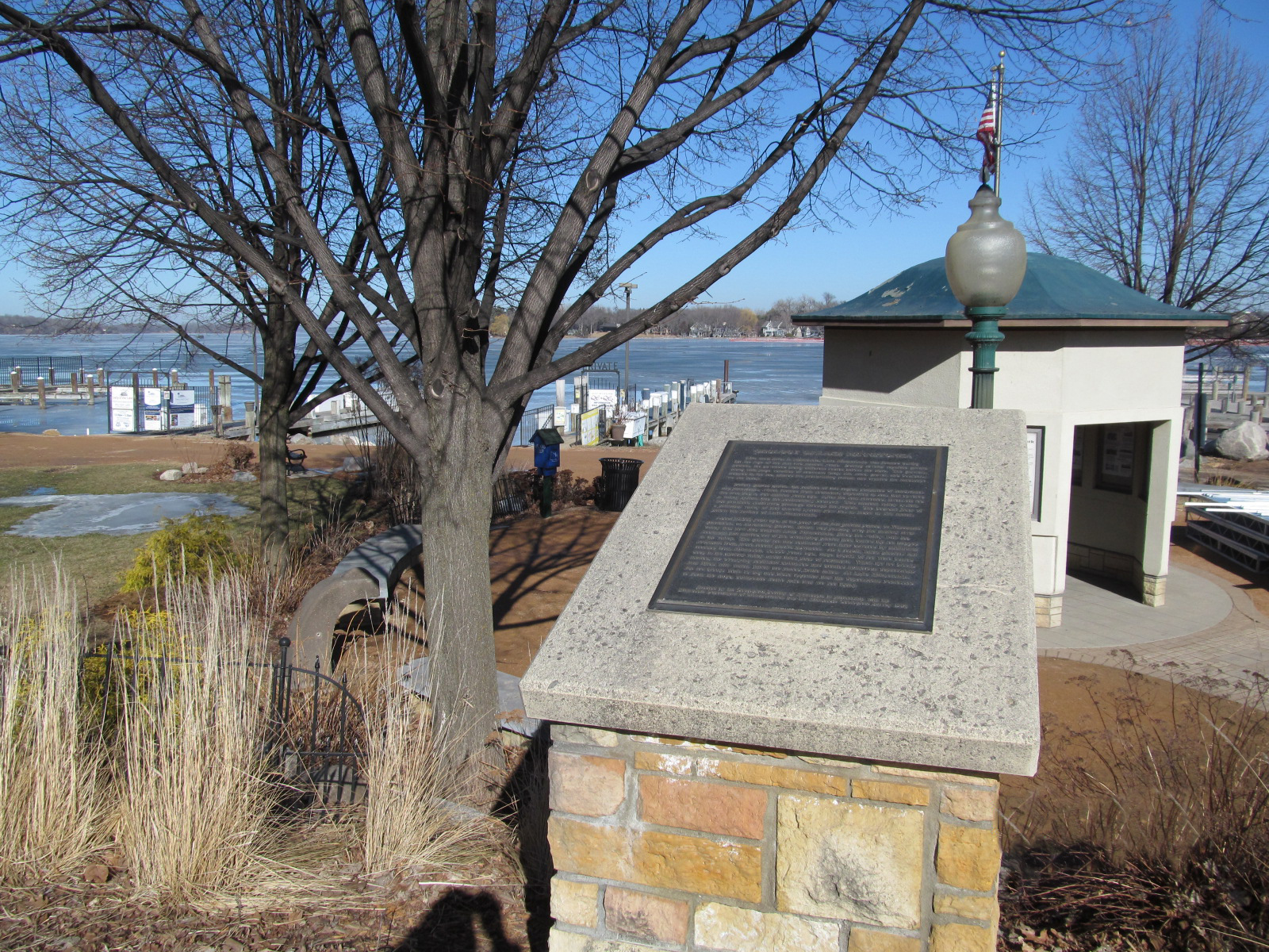
Marker Number:31 Marker Composition: Stone with Bronze plaques Text on Marker:
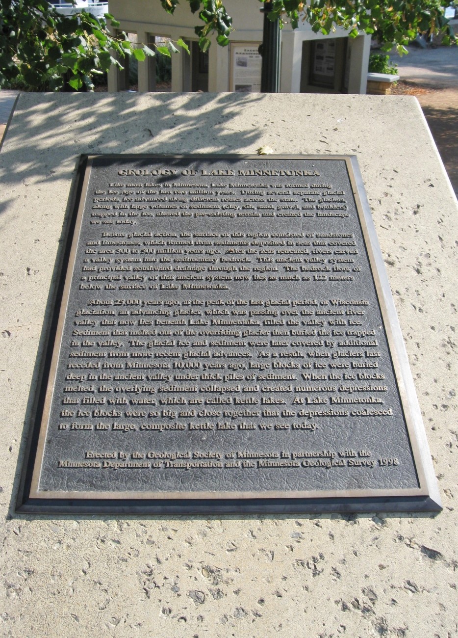
GEOLOGY OF LAKE MINNETONKA Like most lakes in Minnesota, Lake Minnetonka was formed during the Ice Age of the last two million years. During several separate glacial periods, ice advanced along different routes across the state. The glaciers, along with large volumes of sediment (clay, silt, sand, gravel, and boulders) trapped in the ice, altered the preexisting terrain and created the landscape we see today. Before glacial action, the surface of this region consisted of sandstones and limestones which formed from sediments deposited in seas that covered the area 300 to 500 million years ago. After the seas retreated, rivers carved a valley system into the sedimentary bedrock. This ancient valley system had provided southward drainage through the region. The bedrock floor of a principal valley of that ancient system now lies as much as 122 meters below the surface of Lake Minnetonka. About 25,000 years ago, at the peak of the last glacial period, or Wisconsin glaciation, an advancing glacier, which was passing over the ancient river valley that now lies beneath Lake Minnetonka, filled the valley with ice. Sediment that melted out of the overriding glacier then buried the ice trapped in the valley. The glacial ice and sediment were later covered by additional sediment from more recent glacial advances. As a result, when glaciers last receded from Minnesota 10,000 years ago, large blocks of ice were buried deep in the ancient valley under thick piles of sediment. When the ice blocks melted, the overlying sediment collapsed and created numerous depressions that filled with water, which are called kettle lakes. At Lake Minnetonka, the ice blocks were so big and close together that the depressions coalesced to form the large, composite kettle lake that we see today. Erected by the Geological Society of Minnesota in partnership with the Minnesota Department of Transportation and the Minnesota Geological Survey. 1998
Region: Metro Region Date Updated: 6-12-25 Information Needed:
- Marker Images
Condition of Marker: Good Do it Yourself Region: Metro Area Verification: Patrick Steury
Description:
GEOLOGY OF LAKE MINNETONKA Excelsior
Enter Road Address in your cars GPS:
2 Water St, Excelsior, MN 55331
OR
Enter Geographical Coordinates in your cars GPS:
Degrees Lat Long : 44.904528, -93.565306
Latitude: 44°54’16.3″N
Longitude: 93°33’55.1″W
Country: Hennepin County
Where Found:
Marker is in Excelsior, Minnesota, in Hennepin County. Marker is at the intersection of Lake Street and Water Street, on the right when traveling north on Lake Street. Marker is at the Port of Excelsior.
Marker Number: 31
Marker Composition: Stone with Bronze plaques
Text on Marker:
GEOLOGY OF LAKE MINNETONKA Like most lakes in Minnesota, Lake Minnetonka was formed during the Ice Age of the last two million years. During several separate glacial periods, ice advanced along different routes across the state. The glaciers, along with large volumes of sediment (clay, silt, sand, gravel, and boulders) trapped in the ice, altered the preexisting terrain and created the landscape we see today. Before glacial action, the surface of this region consisted of sandstones and limestones which formed from sediments deposited in seas that covered the area 300 to 500 million years ago. After the seas retreated, rivers carved a valley system into the sedimentary bedrock. This ancient valley system had provided southward drainage through the region. The bedrock floor of a principal valley of that ancient system now lies as much as 122 meters below the surface of Lake Minnetonka. About 25,000 years ago, at the peak of the last glacial period, or Wisconsin glaciation, an advancing glacier, which was passing over the ancient river valley that now lies beneath Lake Minnetonka, filled the valley with ice. Sediment that melted out of the overriding glacier then buried the ice trapped in the valley. The glacial ice and sediment were later covered by additional sediment from more recent glacial advances. As a result, when glaciers last receded from Minnesota 10,000 years ago, large blocks of ice were buried deep in the ancient valley under thick piles of sediment. When the ice blocks melted, the overlying sediment collapsed and created numerous depressions that filled with water, which are called kettle lakes. At Lake Minnetonka, the ice blocks were so big and close together that the depressions coalesced to form the large, composite kettle lake that we see today. Erected by the Geological Society of Minnesota in partnership with the Minnesota Department of Transportation and the Minnesota Geological Survey. 1998
Region: Metro Region
Date Updated: 6-12-25 Information Needed:
- Marker Images
Condition of Marker: Good
Do it Yourself Region: Metro Area
Verification: Patrick Steury