Road Marker Views
Description:
Flood Bay Two Harbors
Enter Road Address in your cars GPS:
Lake Superior Agate Geological Marker, 144 MN-61, Two Harbors, MN 55616
OR
Enter Geographical Coordinates in your cars GPS:
Degrees Lat Long: 47.038593,-91.6428681
Latitude: 47°02’19.1″N
Longitude: 91°38’33.3″W
Country: Saint Louis County
Where Found:
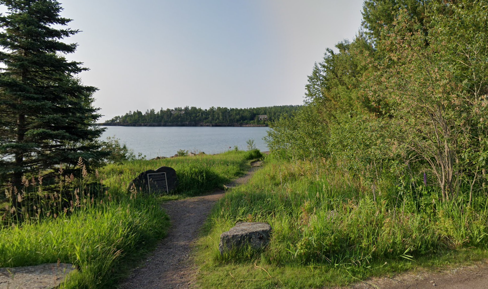
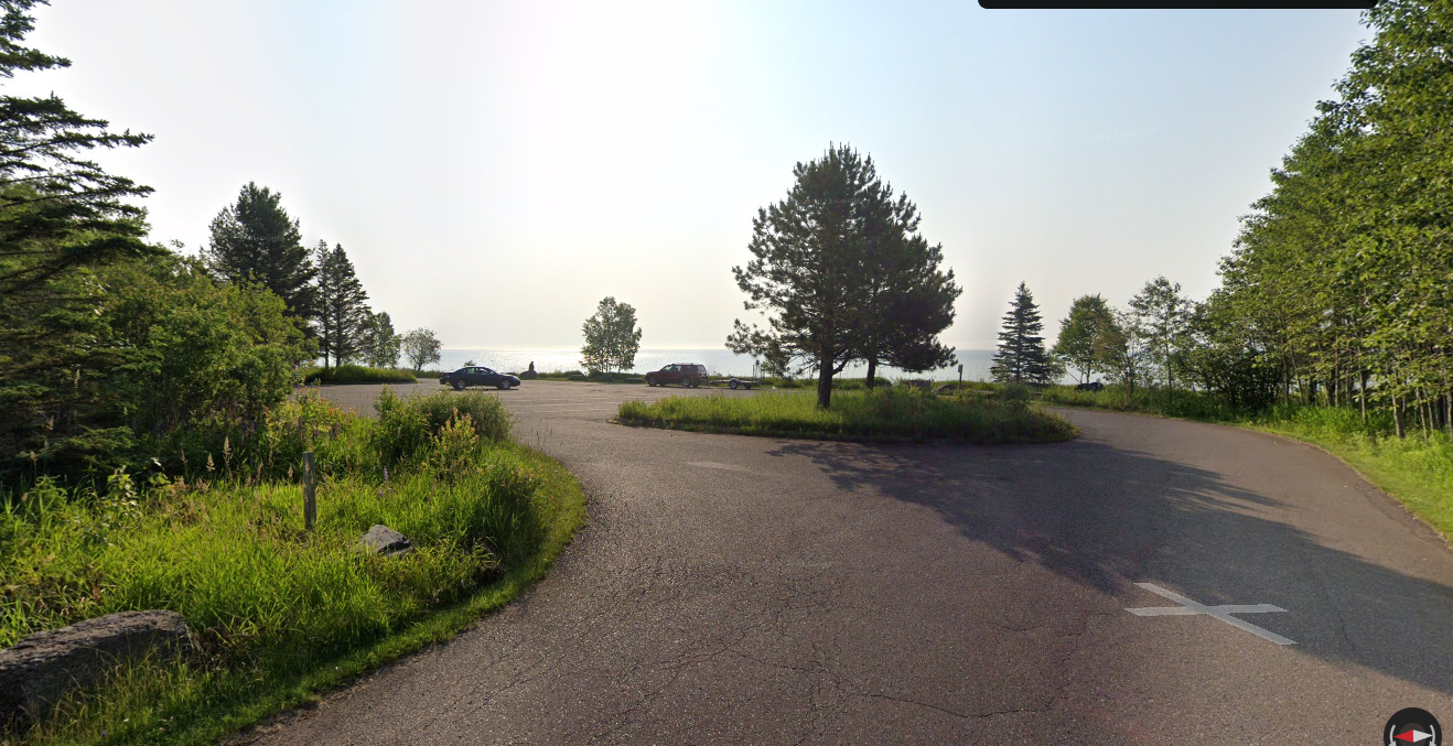
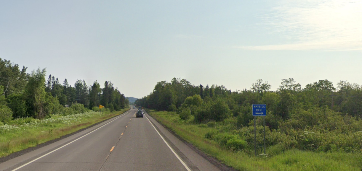
Located in Lake County, 2 miles NE of Two Harbors on the lake side of state highway 61 in Flood Bay State Wayside Park Look for the blue WAYSIDE REST sign, then the right turn comes up fast and is a narrow road that is difficult to find.
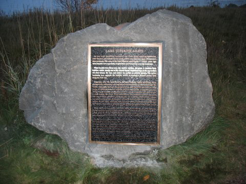
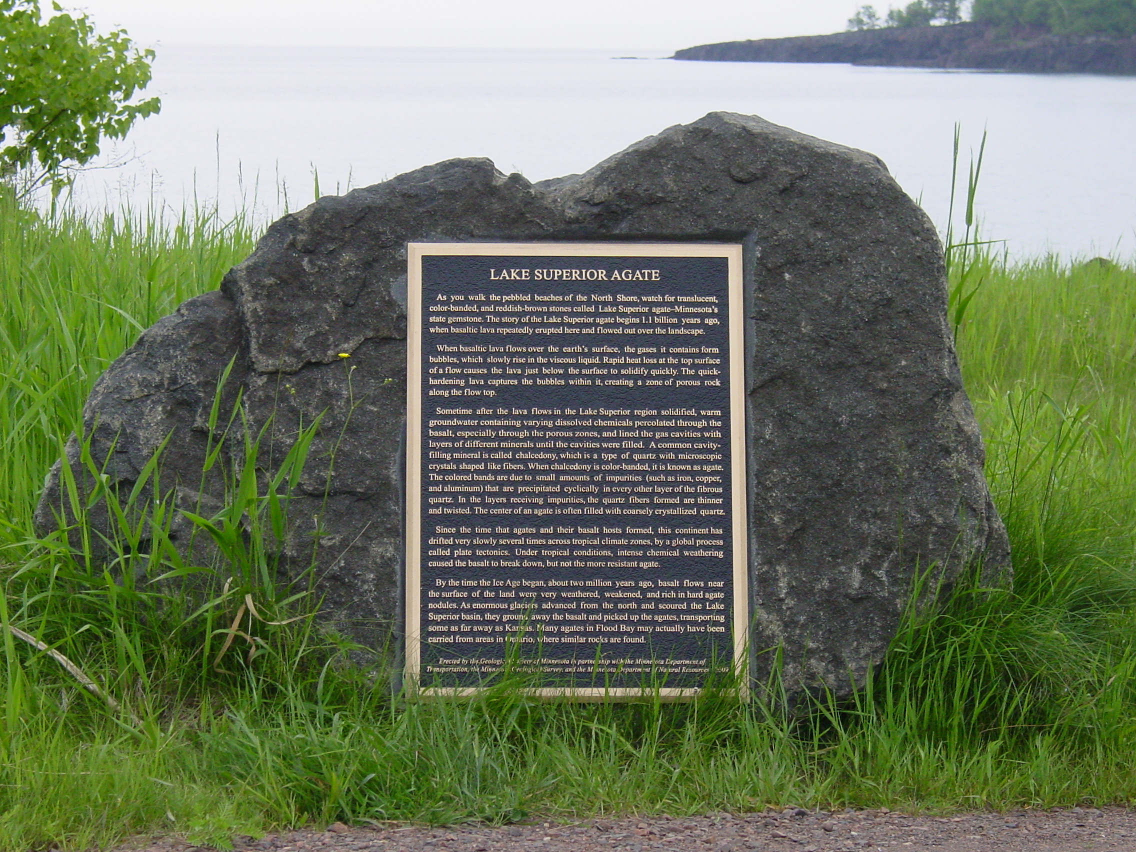
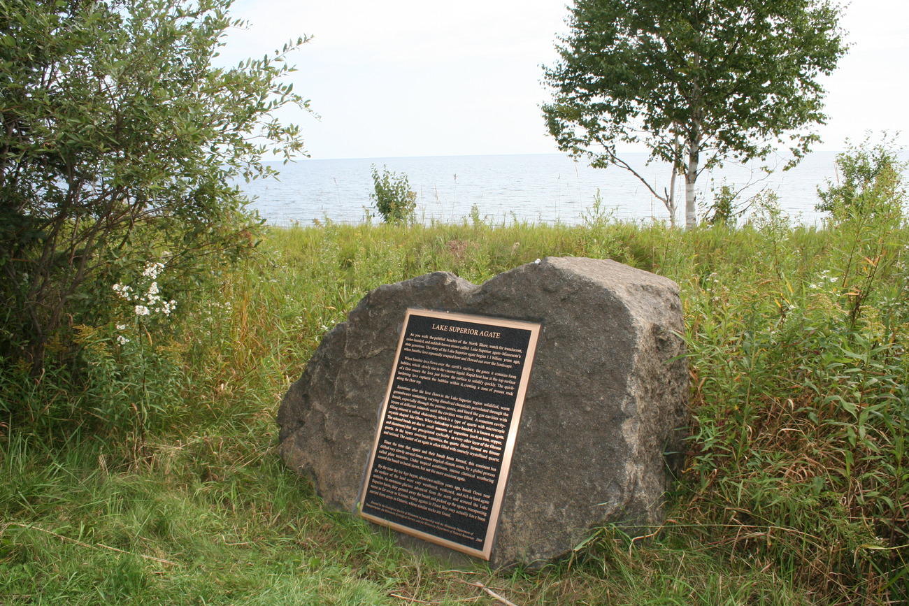
Marker Number:245
Marker Composition: Stone with Bronze plaques
Text on Marker:
Flood Bay State Wayside Park- (Managed by Gooseberry Falls State Park)
LAKE SUPERIOR AGATE
As you walk the pebbled beaches of the North Shore, watch for translucent, color-banded, and reddish-brown stones called Lake Superior agate—Minnesota’s state gemstone. The story of the Lake Superior agate begins 1.1 billion years ago, when basaltic lava repeatedly erupted here and flowed out over the landscape.
When basaltic lava flows over the earth’s surface, the gases it contains form bubbles, which slowly rise in the viscous liquid. Rapid heat loss at the top surface of a flow causes the lava just below the surface to solidify quickly. This quick-hardening lava captures the bubbles within it, creating a zone of porous rock along the flow top.
Sometime after the lava flows in the Lake Superior region solidified, warm groundwater containing varying dissolved chemicals percolated through the basalt, especially through the porous zones, and lined the gas cavities with layers of different minerals until the cavities were filled. A common cavity-filling mineral is called chalcedony, which is a type of quartz with microscopic crystals shaped like fibers. When chalcedony is color-banded, it is known as agate. The colored bands are due to small amounts of impurities (such as iron, copper, and aluminum) that are precipitated cyclically in every other layer of the fibrous quartz. In the layers receiving impurities, the quartz fibers formed are thinner and twisted. The center of an agate is often filled with coarsely crystallized quartz.
Since the time that agates and their basalt hosts formed, this continent has drifted very slowly several times across tropical climate zones, by a global process called plate tectonics. Under tropical conditions, intense chemical weathering caused the basalt to break down, but not the more resistant agate.
By the time the Ice Age began, about two million years ago, basalt flows near the surface of the land were very weathered, weakened, and rich in hard agate nodules. As enormous glaciers advanced from the north and scoured the Lake Superior basin, they ground away the basalt and picked up the agates, transporting some as far away as Kansas. Many agates in Flood Bay may actually have been carried from areas in Ontario, where similar rocks are found.
Erected by the Geological Society of Minnesota in partnership with the Minnesota Department of
Transportation, the Minnesota Geological Survey, and the Minnesota Department of Natural Resources 2009
Region: Northeast Region
Date Updated: 09/17/23
Information Needed:
- Marker Images
Condition of Marker: New
Do it Yourself Region: North Shore
Verification: Alan Smith
Description:
Flood Bay Two Harbors
Enter Road Address in your cars GPS:
Lake Superior Agate Geological Marker, 144 MN-61, Two Harbors, MN 55616
OR
Enter Geographical Coordinates in your cars GPS:
Degrees Lat Long: 47.038593,-91.6428681
Latitude: 47°02’19.1″N
Longitude: 91°38’33.3″W
Country: Saint Louis County
Where Found:
Located in Lake County, 2 miles NE of Two Harbors on the lake side of state highway 61 in Flood Bay State Wayside Park Look for the blue WAYSIDE REST sign, then the right turn comes up fast and is a narrow road that is difficult to find.
Marker Number: 245
Marker Composition: Stone with Bronze plaques
Text on Marker:
Flood Bay State Wayside Park- (Managed by Gooseberry Falls State Park)
LAKE SUPERIOR AGATE
As you walk the pebbled beaches of the North Shore, watch for translucent, color-banded, and reddish-brown stones called Lake Superior agate—Minnesota’s state gemstone. The story of the Lake Superior agate begins 1.1 billion years ago, when basaltic lava repeatedly erupted here and flowed out over the landscape.
When basaltic lava flows over the earth’s surface, the gases it contains form bubbles, which slowly rise in the viscous liquid. Rapid heat loss at the top surface of a flow causes the lava just below the surface to solidify quickly. This quick-hardening lava captures the bubbles within it, creating a zone of porous rock along the flow top.
Sometime after the lava flows in the Lake Superior region solidified, warm groundwater containing varying dissolved chemicals percolated through the basalt, especially through the porous zones, and lined the gas cavities with layers of different minerals until the cavities were filled. A common cavity-filling mineral is called chalcedony, which is a type of quartz with microscopic crystals shaped like fibers. When chalcedony is color-banded, it is known as agate. The colored bands are due to small amounts of impurities (such as iron, copper, and aluminum) that are precipitated cyclically in every other layer of the fibrous quartz. In the layers receiving impurities, the quartz fibers formed are thinner and twisted. The center of an agate is often filled with coarsely crystallized quartz.
Since the time that agates and their basalt hosts formed, this continent has drifted very slowly several times across tropical climate zones, by a global process called plate tectonics. Under tropical conditions, intense chemical weathering caused the basalt to break down, but not the more resistant agate.
By the time the Ice Age began, about two million years ago, basalt flows near the surface of the land were very weathered, weakened, and rich in hard agate nodules. As enormous glaciers advanced from the north and scoured the Lake Superior basin, they ground away the basalt and picked up the agates, transporting some as far away as Kansas. Many agates in Flood Bay may actually have been carried from areas in Ontario, where similar rocks are found.
Erected by the Geological Society of Minnesota in partnership with the Minnesota Department of
Transportation, the Minnesota Geological Survey, and the Minnesota Department of Natural Resources 2009
Region: Northeast Region
Date Updated: 09/17/23 Information Needed:
- Marker Images
Condition of Marker: New
Do it Yourself Region: North Shore
Verification: Alan Smith