Road Marker Views
Description:
Enter Road Address in your cars GPS: 24327 165th Ave Fort Ripley, Minnesota OR Enter Geographical Coordinates in your cars GPS:
Degrees Lat Long: 46.114967, -94.313267
Latitude: 46°06’53.9″N
Longitude: 94°18’47.8″W
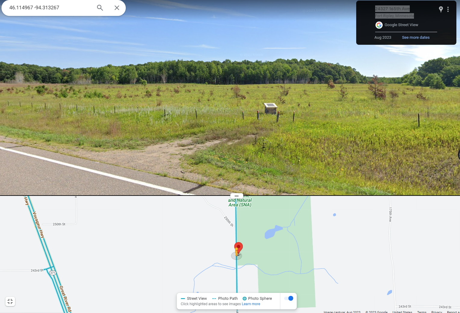
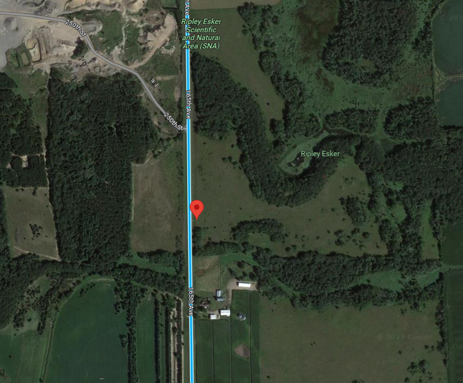
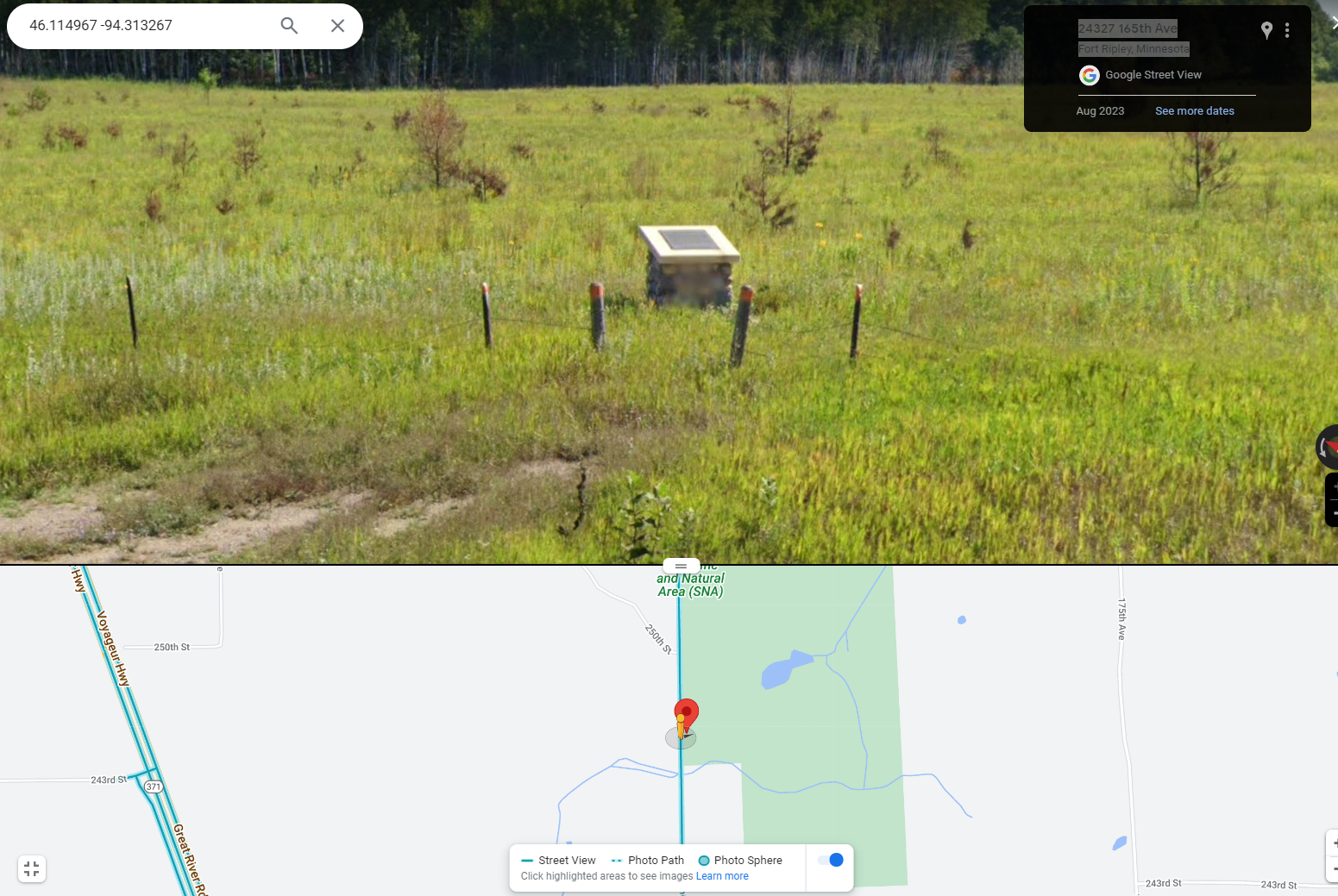
Directions: From Little Falls, travel north seven miles on state highway 371. (The esker is the low tree-covered ridge to your right.) Turn right onto county road 48 and travel 0.7 miles, then turn left onto county road 282 and drive 1 mile north. (You are on top of esker.) The marker is on the east side of 282, in tall grass. The Ripley Esker Scientific and Natural Area (SNA) is located a short distance north. No road sign.
Marker Number:308 Marker Composition: Stone with Bronze plaques Text on Marker:
THE RIPLEY ESKER
An esker is a landform built of sand and gravel deposited by a meltwater stream that flowed beneath a glacier. The Ripley esker is a classic esker; it stands 3 to 18 meters- above the surrounding plain, and is about 68 to 76 meters wide. Although the Ripley esker is broken into several segments, it has an overall length of about 11 kilometers.
The narrow, sinuous, steep-sided ridge of sand and gravel that forms the esker is flanked on both sides by a row of small lakes and depressions. A vigorous subglacial stream eroded a channel bed initially wide enough to contain those flanking depressions. The ice that surrounded the stream was under pressure from the glacier’s weight. When the stream’s flow diminished, the ice squeezed inward to form a narrower tunnel. The smaller, slower stream in the smaller ice tunnel could not carry as much sediment, and it began to deposit it on the streambed. As the sediments accumulated, they raised the level of the streambed and along with it the stream, which continually melted the ice above it and kept an open passage. This narrow, raised streambed grew to a height that became the ridge one sees today above the surrounding plain. The esker slopes down from the ridge along its length because the sediment slumped after the glacier melted away.
The Ripley esker was formed beneath a tongue-shaped lobe of ice called the Superior lobe, which flowed into this area from the northeast about 20,000 to 15,000 years ago. The esker was deposited as the Superior lobe receded. The sands and gravels of the esker were derived from the Lake Superior basin and include reddish volcanic and sedimentary rocks as well as Lake Superior agate. The pile of glacial sediment (silt, sand, gravel, and boulders) left at the edge of the Superior lobe at the point of its furthest advance is the St. Croix moraine. It is the broad swath of high hills that lies to the west of the esker. From this point the best views of the esker are in the spring and fall, when the trees have no leaves and the prairie grasses are the dominant feature on the top of the esker.
Erected by the Geological Society of Minnesota in partnership with the Minnesota Department of Transportation, the Minnesota Geological Survey, and the Minnesota Department of Natural Resources. 1998
Region: North Central/West Region Date Updated: 6-12-25 Information Needed:
- Marker Images
Condition of Marker: Good Do it Yourself Region: Brainerd-Mille Lacs Verification: Patrick Steury
Description:
Enter Road Address in your cars GPS:
24327 165th Ave Fort Ripley, Minnesota
OR
Enter Geographical Coordinates in your cars GPS:
Degrees Lat Long: 46.114967, -94.313267
Latitude: 46°06’53.9″N
Longitude: 94°18’47.8″W
Country: Morrison County
Where Found:
Directions: From Little Falls, travel north seven miles on state highway 371. (The esker is the low tree-covered ridge to your right.) Turn right onto county road 48 and travel 0.7 miles, then turn left onto county road 282 and drive 1 mile north. (You are on top of esker.) The marker is on the east side of 282, in tall grass. The Ripley Esker Scientific and Natural Area (SNA) is located a short distance north. No road sign.
Marker Number: 308
Marker Composition: Stone with Bronze plaques
Text on Marker:
THE RIPLEY ESKER
An esker is a landform built of sand and gravel deposited by a meltwater stream that flowed beneath a glacier. The Ripley esker is a classic esker; it stands 3 to 18 meters- above the surrounding plain, and is about 68 to 76 meters wide. Although the Ripley esker is broken into several segments, it has an overall length of about 11 kilometers.
The narrow, sinuous, steep-sided ridge of sand and gravel that forms the esker is flanked on both sides by a row of small lakes and depressions. A vigorous subglacial stream eroded a channel bed initially wide enough to contain those flanking depressions. The ice that surrounded the stream was under pressure from the glacier’s weight. When the stream’s flow diminished, the ice squeezed inward to form a narrower tunnel. The smaller, slower stream in the smaller ice tunnel could not carry as much sediment, and it began to deposit it on the streambed. As the sediments accumulated, they raised the level of the streambed and along with it the stream, which continually melted the ice above it and kept an open passage. This narrow, raised streambed grew to a height that became the ridge one sees today above the surrounding plain. The esker slopes down from the ridge along its length because the sediment slumped after the glacier melted away.
The Ripley esker was formed beneath a tongue-shaped lobe of ice called the Superior lobe, which flowed into this area from the northeast about 20,000 to 15,000 years ago. The esker was deposited as the Superior lobe receded. The sands and gravels of the esker were derived from the Lake Superior basin and include reddish volcanic and sedimentary rocks as well as Lake Superior agate. The pile of glacial sediment (silt, sand, gravel, and boulders) left at the edge of the Superior lobe at the point of its furthest advance is the St. Croix moraine. It is the broad swath of high hills that lies to the west of the esker. From this point the best views of the esker are in the spring and fall, when the trees have no leaves and the prairie grasses are the dominant feature on the top of the esker.
Erected by the Geological Society of Minnesota in partnership with the Minnesota Department of Transportation, the Minnesota Geological Survey, and the Minnesota Department of Natural Resources. 1998
Region: North Central/West Region
Date Updated: 6-12-25 Information Needed:
- Marker Images
Condition of Marker: Good
Do it Yourself Region: Brainerd-Mille Lacs
Verification: Patrick Steury