Road Marker Views
Description:
Enter Road Address in your cars GPS: 987 US-12, Ortonville, MN 56278 OR Enter Geographical Coordinates in your cars GPS:
Degrees Lat Long: 45.296889, -96.432500
Latitude: 45°17’48.8″N
Longitude: 96°25’57.0″W
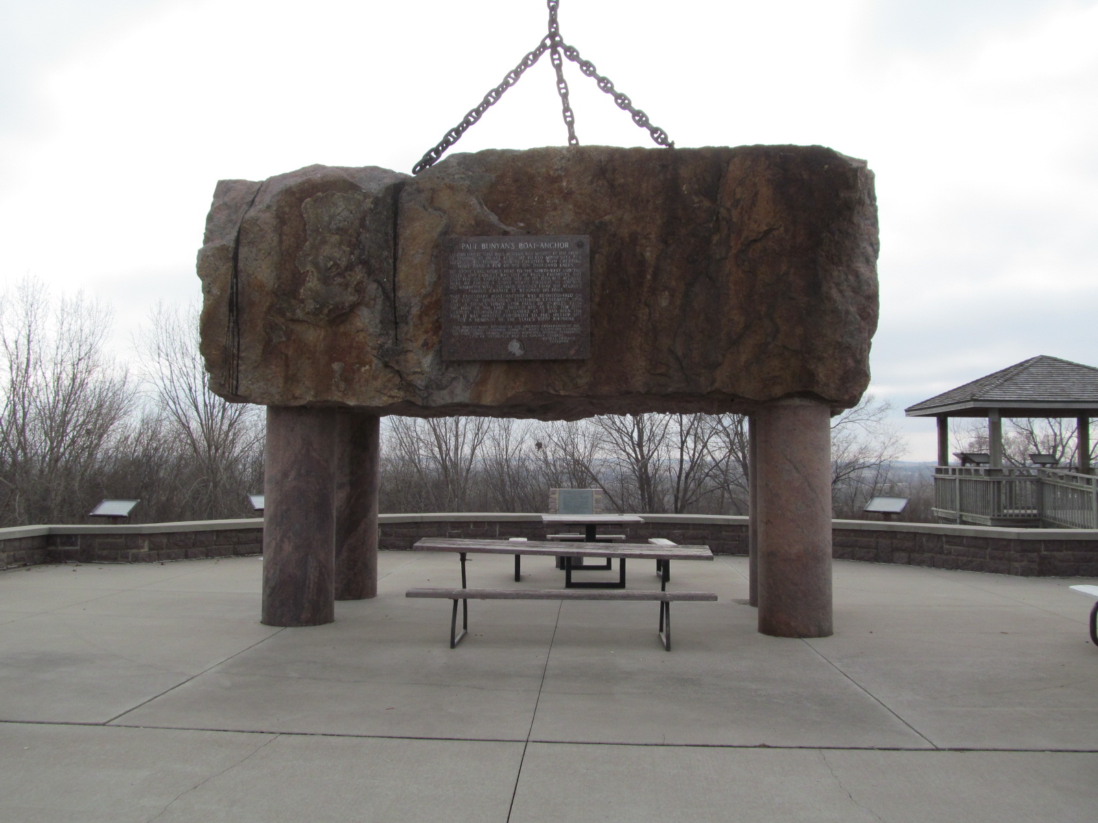
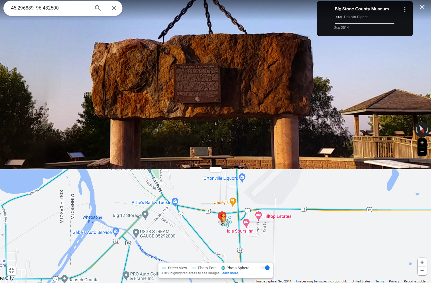
Located 1000 feet west of the junction of US Hwy 12 and 75, about 0.5 miles east of Ortonville In a park showing historic and geologic features of the area. Trees now obscure the view of the valley.
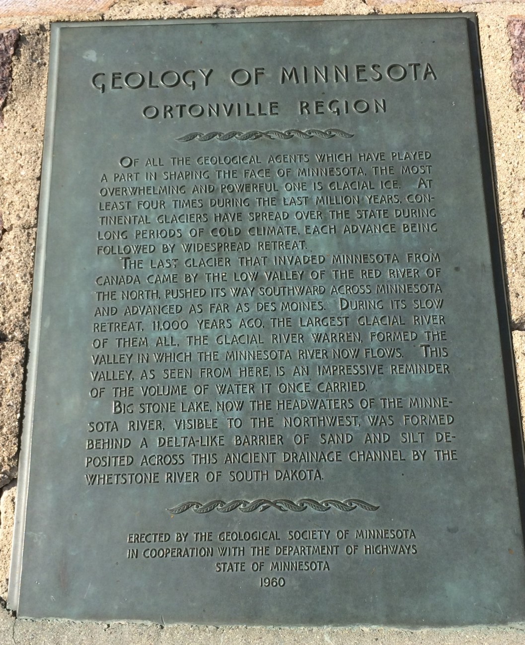
Marker Number:65 Marker Composition: Stone with Bronze plaques Text on Marker:
ORTONVILLE REGION
Of all the geological agents which have played a part in shaping the face of Minnesota, the most overwhelming and powerful one is glacial ice. At least four times during the last million years, continental glaciers have spread over the state during long periods of cold climate, each advance being followed by widespread retreat.
The last glacier that invaded Minnesota from Canada came by the low valley of the Red River of the North, pushed its way southward across Minnesota and advanced as far as Des Moines. During its slow retreat, 11,000 years ago, the largest glacial river of them all, the Glacial River Warren, formed the valley in which the Minnesota River now flows. This valley, as seen from here, is an impressive reminder of the volume of water it once carried.
Big Stone Lake, now the headwaters of the Minnesota River, visible to the northwest, was formed be-hind a delta-like barrier of sand and silt deposited across this ancient drainage channel by the Whetstone River of South Dakota.
Erected by the Geological Society of Minnesota in cooperation with the Department of Highways, State of Minnesota. 1960
Region: South Central/West Region Date Updated: 6-12-25 Information Needed:
- Marker Images
Condition of Marker: Fair Do it Yourself Region: Alexandria and Big Stone, Minnesota River Valley Verification: Patrick Steury
Description:
Enter Road Address in your cars GPS:
987 US-12, Ortonville, MN 56278
OR
Enter Geographical Coordinates in your cars GPS:
Degrees Lat Long: 45.296889, -96.432500
Latitude: 45°17’48.8″N
Longitude: 96°25’57.0″W
Country: Big Stone County
Where Found:
Located 1000 feet west of the junction of US Hwy 12 and 75, about 0.5 miles east of Ortonville In a park showing historic and geologic features of the area. Trees now obscure the view of the valley.
Marker Number: 65
Marker Composition: Stone with Bronze plaques
Text on Marker:
ORTONVILLE REGION
Of all the geological agents which have played a part in shaping the face of Minnesota, the most overwhelming and powerful one is glacial ice. At least four times during the last million years, continental glaciers have spread over the state during long periods of cold climate, each advance being followed by widespread retreat.
The last glacier that invaded Minnesota from Canada came by the low valley of the Red River of the North, pushed its way southward across Minnesota and advanced as far as Des Moines. During its slow retreat, 11,000 years ago, the largest glacial river of them all, the Glacial River Warren, formed the valley in which the Minnesota River now flows. This valley, as seen from here, is an impressive reminder of the volume of water it once carried.
Big Stone Lake, now the headwaters of the Minnesota River, visible to the northwest, was formed be-hind a delta-like barrier of sand and silt deposited across this ancient drainage channel by the Whetstone River of South Dakota.
Erected by the Geological Society of Minnesota in cooperation with the Department of Highways, State of Minnesota. 1960
Region: South Central/West Region
Date Updated: 6-12-25 Information Needed:
- Marker Images
Condition of Marker: Fair
Do it Yourself Region: Alexandria and Big Stone, Minnesota River Valley
Verification: Patrick Steury