Road Marker Views
Description:
Enter Road Address in your cars GPS: 1060 Mounds Blvd, St Paul, MN 55106 OR Enter Geographical Coordinates in your cars GPS:
Degrees Lat Long: 44.945333, -93.054833
Latitude: 44°56’43.2″N
Longitude: 93°03’17.4″W
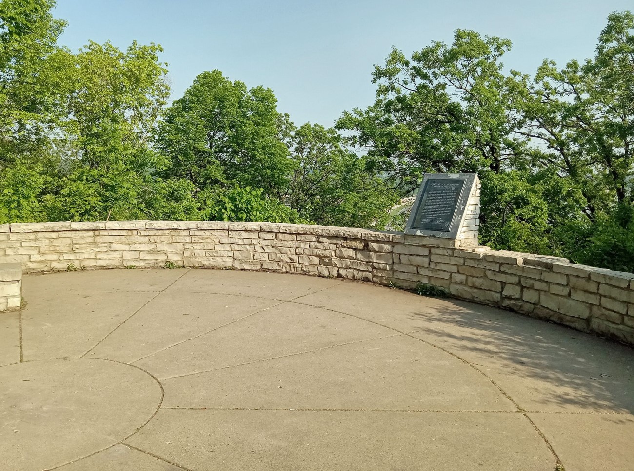
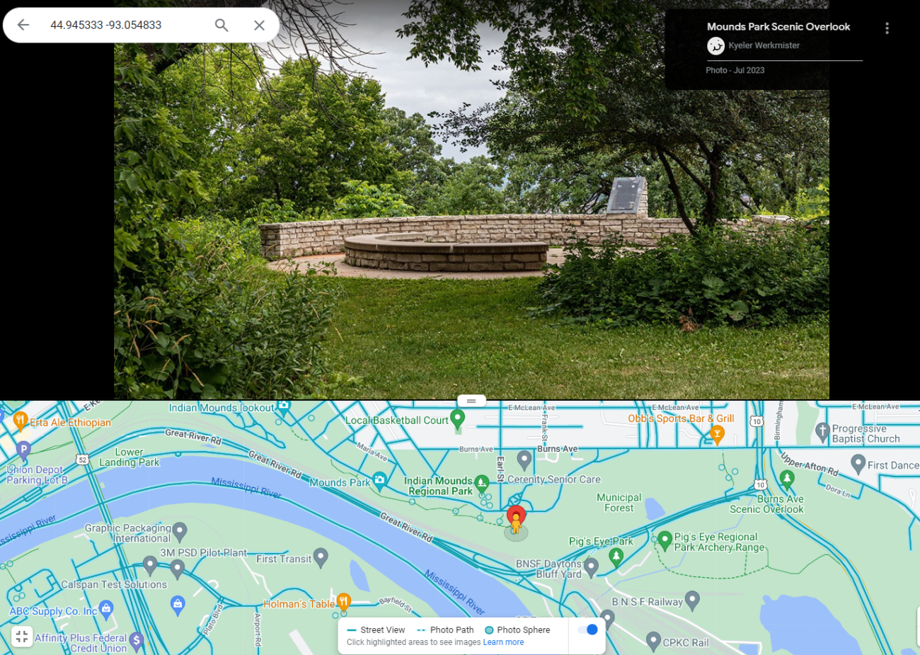
Marker is in Saint Paul, Minnesota, in Ramsey County. It is in Dayton’s Bluff. Marker can be reached from the intersection of Mounds Boulevard and Earl Street, on the right when traveling east. The marker is in Indian Mounds Park, at an overlook southeast of the pavilion. There is a small parking lot and abundant street parking nearby.
Stolen Please contact the St. Paul Police with any information.
Marker Number:38 Marker Composition: Stone with Bronze plaques Text on Marker:
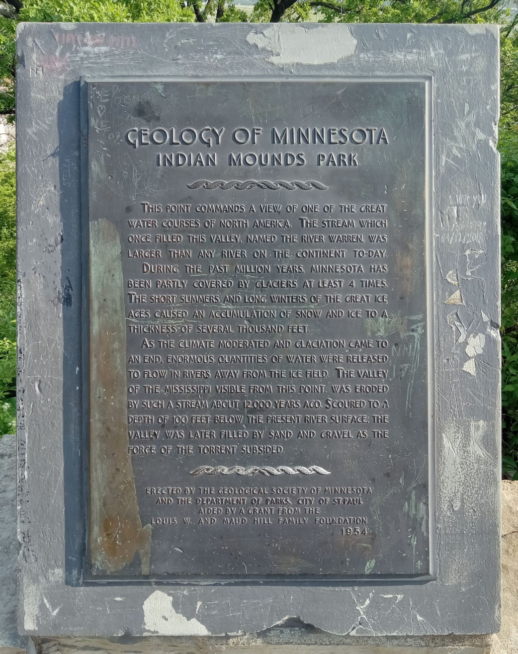
INDIAN MOUNDS PARK
Located in Indian Mounds Park on Mounds Boulevard at Earl Street in St. Paul
This point commands a view of one of the great water courses of North America. The stream which once filled this valley, named the River Warren, was larger than any river on the continent today.
During the past million years, Minnesota has been partly covered by glaciers at least 4 times. The short summers and long winters of the great ice ages caused an accumulation of snow and ice to a thickness of several thousand feet.
As the climate moderated and glaciation came to an end, enormous quantities of water were released to flow in rivers away from the ice field. The valley of the Mississippi visible from this point, was eroded by such a stream about 12,000 years ago. Scoured to a depth of 100 feet below the present river surface, the valley was later filled by sand and gravel as the force of the torrent subsided.
Erected by the Geological Society of Minnesota and the Department of Parks, City of St. Paul aided by a grant from the Louis W. and Maud Hill Family Foundation. 1954
Region: Metro Region Date Updated: 6-12-25 Information Needed:
- Marker Images
Condition of Marker: Fair Do it Yourself Region: Metro Area Verification: Patrick Steury
Description:
Enter Road Address in your cars GPS:
1060 Mounds Blvd, St Paul, MN 55106
OR
Enter Geographical Coordinates in your cars GPS:
Degrees Lat Long: 44.945333, -93.054833
Latitude: 44°56’43.2″N
Longitude: 93°03’17.4″W
Country: Ramsey County
Where Found:
Marker is in Saint Paul, Minnesota, in Ramsey County. It is in Dayton’s Bluff. Marker can be reached from the intersection of Mounds Boulevard and Earl Street, on the right when traveling east. The marker is in Indian Mounds Park, at an overlook southeast of the pavilion. There is a small parking lot and abundant street parking nearby.
Stolen Please contact the St. Paul Police with any information.
Marker Number: 38
Marker Composition: Stone with Bronze plaques
Text on Marker:
INDIAN MOUNDS PARK
Located in Indian Mounds Park on Mounds Boulevard at Earl Street in St. Paul
This point commands a view of one of the great water courses of North America. The stream which once filled this valley, named the River Warren, was larger than any river on the continent today.
During the past million years, Minnesota has been partly covered by glaciers at least 4 times. The short summers and long winters of the great ice ages caused an accumulation of snow and ice to a thickness of several thousand feet.
As the climate moderated and glaciation came to an end, enormous quantities of water were released to flow in rivers away from the ice field. The valley of the Mississippi visible from this point, was eroded by such a stream about 12,000 years ago. Scoured to a depth of 100 feet below the present river surface, the valley was later filled by sand and gravel as the force of the torrent subsided.
Erected by the Geological Society of Minnesota and the Department of Parks, City of St. Paul aided by a grant from the Louis W. and Maud Hill Family Foundation. 1954
Region: Metro Region
Date Updated: 6-12-25 Information Needed:
- Marker Images
Condition of Marker: Fair
Do it Yourself Region: Metro Area
Verification: Patrick Steury