Road Marker Views
Enter Road Address in your cars GPS: TH 55, Glenwood, MN 56334 OR Enter Geographical Coordinates in your cars GPS:
Degrees Lat Long: 45.661889, -95.382639
Latitude: 45°39’42.8″N
Longitude: 95°22’57.5″W
Mt. Lookout Park at HWY 55 and 14th Avenue NE, just south of water tower
Marker Number:322 Marker Composition: Stone with Bronze plaques Text on Marker:
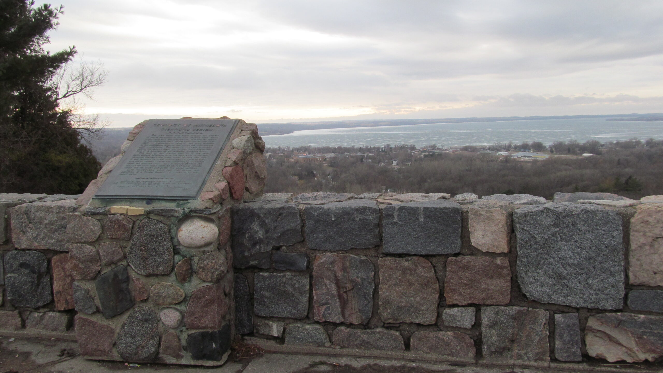
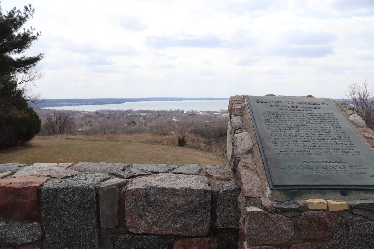
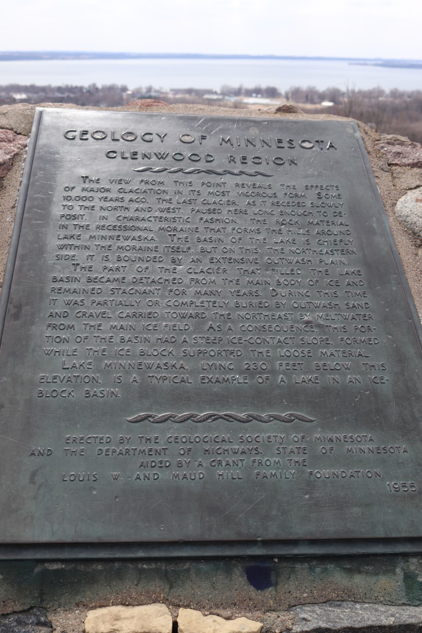
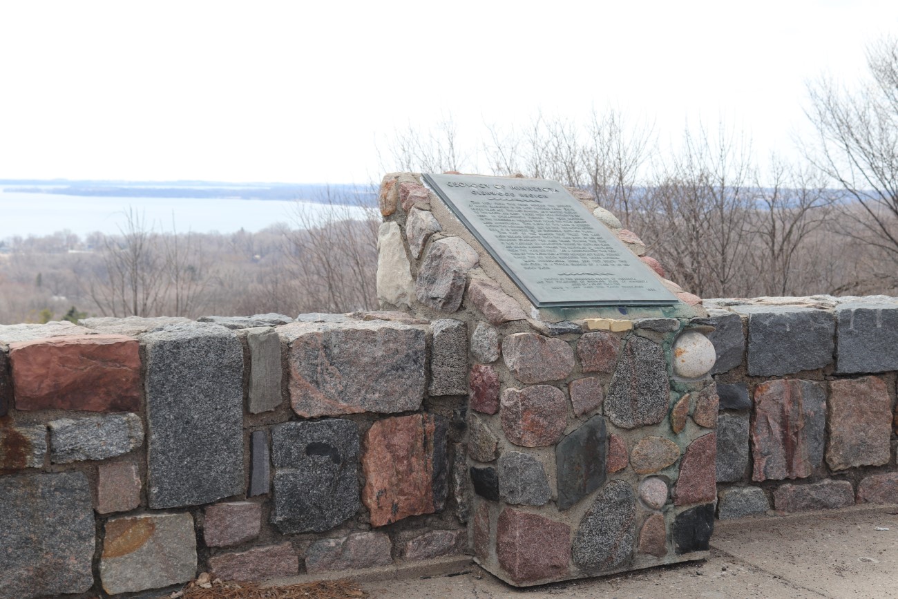
GLENWOOD REGION
The view from this point reveals the effects of major glaciation in its most vigorous form. Some 10,000 years ago, the last glacier, as it receded slowly to the north and west, paused here long enough to deposit, in characteristic fashion, the rock material in the recessional moraine that forms the hills around Lake Minnewaska. The basin of the lake is chiefly within the moraine itself, but on this, the northeastern side, it is bounded by an extensive outwash plain.
The part of the glacier that filled the lake basin be-came detached from the main body of ice and remained stagnant for many years. During this time it was partially or completely buried by outwash sand and gravel carried toward the northeast by meltwater from the main ice field. As a consequence, this portion of the basin had a steep ice-contact slope, formed while the ice block supported the loose material.
Lake Minnewaska, lying 230 feet below this elevation, is a typical example of a lake in an ice-block basin.
Erected by the Geological Society of Minnesota and the Department of Highways, State of Minnesota aided by a grant from the Louis W. and Maud Hill Family Foundation. 1955
Region: North Central/West Region Date Updated: 6-12-25 Information Needed:
- Marker Images
Condition of Marker: Do it Yourself Region: Alexandria and Big Stone Verification: Patrick Steury
Enter Road Address in your cars GPS:
TH 55, Glenwood, MN 56334
OR
Enter Geographical Coordinates in your cars GPS:
Degrees Lat Long: 45.661889, -95.382639
Latitude: 45°39’42.8″N
Longitude: 95°22’57.5″W
Country: Pope County
Where Found:
Mt. Lookout Park at HWY 55 and 14th Avenue NE, just south of water tower
Marker Number: 322
Marker Composition: Stone with Bronze plaques
Text on Marker:
GLENWOOD REGION
The view from this point reveals the effects of major glaciation in its most vigorous form. Some 10,000 years ago, the last glacier, as it receded slowly to the north and west, paused here long enough to deposit, in characteristic fashion, the rock material in the recessional moraine that forms the hills around Lake Minnewaska. The basin of the lake is chiefly within the moraine itself, but on this, the northeastern side, it is bounded by an extensive outwash plain.
The part of the glacier that filled the lake basin be-came detached from the main body of ice and remained stagnant for many years. During this time it was partially or completely buried by outwash sand and gravel carried toward the northeast by meltwater from the main ice field. As a consequence, this portion of the basin had a steep ice-contact slope, formed while the ice block supported the loose material.
Lake Minnewaska, lying 230 feet below this elevation, is a typical example of a lake in an ice-block basin.
Erected by the Geological Society of Minnesota and the Department of Highways, State of Minnesota aided by a grant from the Louis W. and Maud Hill Family Foundation. 1955
Region: North Central/West Region
Date Updated: 6-12-25 Information Needed:
- Marker Images
Condition of Marker:
Do it Yourself Region: Alexandria and Big Stone
Verification: Patrick Steury