Road Marker Views
Enter Road Address in your cars GPS: 29223 County 28 Blvd, Frontenac, MN 55026 OR Enter Geographical Coordinates in your cars GPS:
Degrees Lat Long: 44.534927, -92.336322
Latitude: 44°32’05.7″N
Longitude: 92°20’10.8″W
Located on U.S. highway 61 in Frontenac State Park
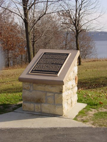
Marker Number:94 Marker Composition: Stone with Bronze plaques Text on Marker:
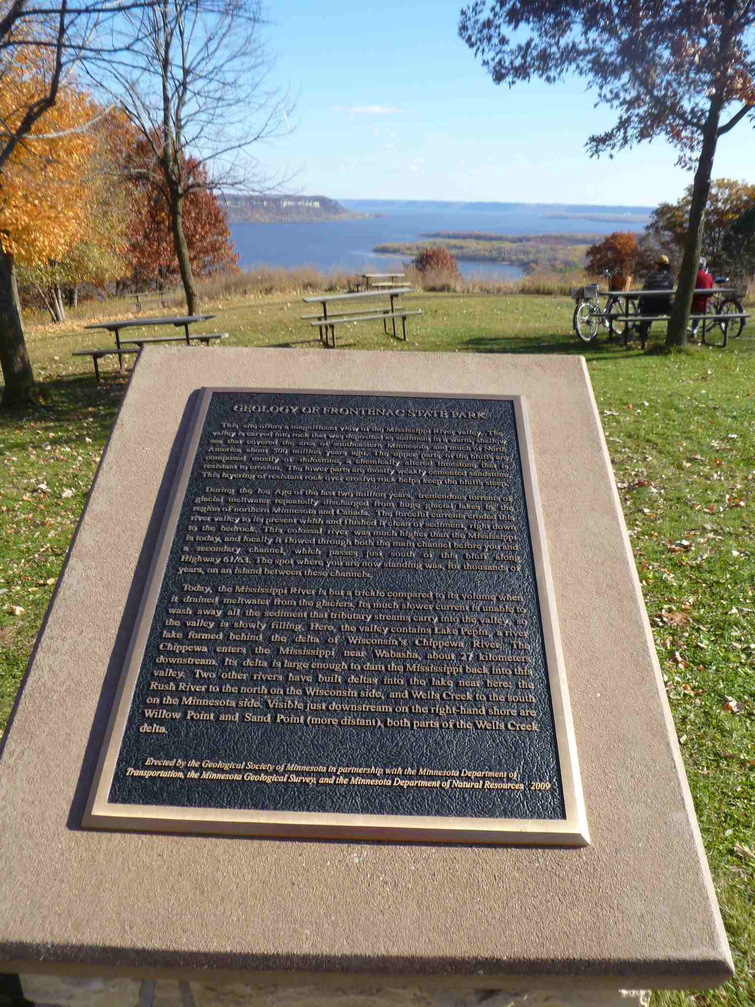
GEOLOGY OF FRONTENAC STATE PARK
This site offers a magnificent view of the Mississippi River valley. The valley is carved into rock that was deposited as sediment in a warm, shallow sea that covered the area of southeastern Minnesota and much of North America about 500 million years ago. The upper parts of the bluffs are composed mostly of dolostone, a chemically altered limestone that is resistant to erosion. The lower parts are mostly weakly cemented sandstone. This layering of resistant rock over erosive rock helps keep the bluffs steep.
During the Ice Age of the last two million years, tremendous torrents of glacial meltwater repeatedly discharged from huge glacial lakes in the region of northern Minnesota and Canada. The forceful currents eroded this river valley to its present width and flushed it clean of sediment, right down to the bedrock. This colossal river was much higher than the Mississippi is today, and locally it flowed through both the main channel before you and a secondary channel, which passes just south of this bluff along Highway 61/63. The spot where you are now standing was, for thousands of years, on an island between these channels.
Today, the Mississippi River is but a trickle compared to its volume when it drained meltwater from the glaciers. Its much slower current is unable to wash away all the sediment that tributary streams carry into the valley, so the valley is slowly filling. Here, the valley contains Lake Pepin, a river lake formed behind the delta of Wisconsin’s Chippewa River. The Chippewa enters the Mississippi near Wabasha, about 27 kilometers downstream. Its delta is large enough to dam the Mississippi back into this valley. Two other rivers have built deltas into the lake near here: the Rush River to the north on the Wisconsin side, and Wells Creek to the south on the Minnesota side. Visible just downstream on the right-hand shore are Willow Point and Sand Point (more distant), both parts of the Wells Creek delta.
Erected by the Geological Society of Minnesota in partnership with the Minnesota Department of
Transportation, the Minnesota Geological Survey, and the Minnesota Department of Natural Resources 2009
Region: Southeastern Region Date Updated: 6-12-25 Information Needed:
- Marker Images
Condition of Marker: Good Do it Yourself Region: Mississippi River Valley Verification: Patrick Steury
Enter Road Address in your cars GPS:
29223 County 28 Blvd, Frontenac, MN 55026
OR
Enter Geographical Coordinates in your cars GPS:
Degrees Lat Long: 44.534927, -92.336322
Latitude: 44°32’05.7″N
Longitude: 92°20’10.8″W
Country: Goodhue County
Where Found:
Located on U.S. highway 61 in Frontenac State Park
Marker Number: 94
Marker Composition: Stone with Bronze plaques
Text on Marker:
GEOLOGY OF FRONTENAC STATE PARK
This site offers a magnificent view of the Mississippi River valley. The valley is carved into rock that was deposited as sediment in a warm, shallow sea that covered the area of southeastern Minnesota and much of North America about 500 million years ago. The upper parts of the bluffs are composed mostly of dolostone, a chemically altered limestone that is resistant to erosion. The lower parts are mostly weakly cemented sandstone. This layering of resistant rock over erosive rock helps keep the bluffs steep.
During the Ice Age of the last two million years, tremendous torrents of glacial meltwater repeatedly discharged from huge glacial lakes in the region of northern Minnesota and Canada. The forceful currents eroded this river valley to its present width and flushed it clean of sediment, right down to the bedrock. This colossal river was much higher than the Mississippi is today, and locally it flowed through both the main channel before you and a secondary channel, which passes just south of this bluff along Highway 61/63. The spot where you are now standing was, for thousands of years, on an island between these channels.
Today, the Mississippi River is but a trickle compared to its volume when it drained meltwater from the glaciers. Its much slower current is unable to wash away all the sediment that tributary streams carry into the valley, so the valley is slowly filling. Here, the valley contains Lake Pepin, a river lake formed behind the delta of Wisconsin’s Chippewa River. The Chippewa enters the Mississippi near Wabasha, about 27 kilometers downstream. Its delta is large enough to dam the Mississippi back into this valley. Two other rivers have built deltas into the lake near here: the Rush River to the north on the Wisconsin side, and Wells Creek to the south on the Minnesota side. Visible just downstream on the right-hand shore are Willow Point and Sand Point (more distant), both parts of the Wells Creek delta.
Erected by the Geological Society of Minnesota in partnership with the Minnesota Department of
Transportation, the Minnesota Geological Survey, and the Minnesota Department of Natural Resources 2009
Region: Southeastern Region
Date Updated: 6-12-25 Information Needed:
- Marker Images
Condition of Marker: Good
Do it Yourself Region: Mississippi River Valley
Verification: Patrick Steury