Road Marker Views
Description:
Enter Road Address in your cars GPS: Brainerd Region Geological Marker, 19835 MN-371, Brainerd, MN 56401 OR Enter Geographical Coordinates in your cars GPS:
Degrees Lat Long 46.4415315,-94.307247
Latitude 46°26’29.5″N
Longitude 94°18’16.8″W
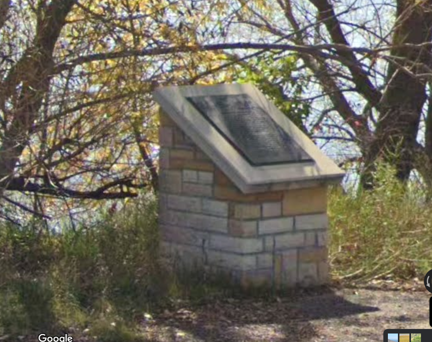
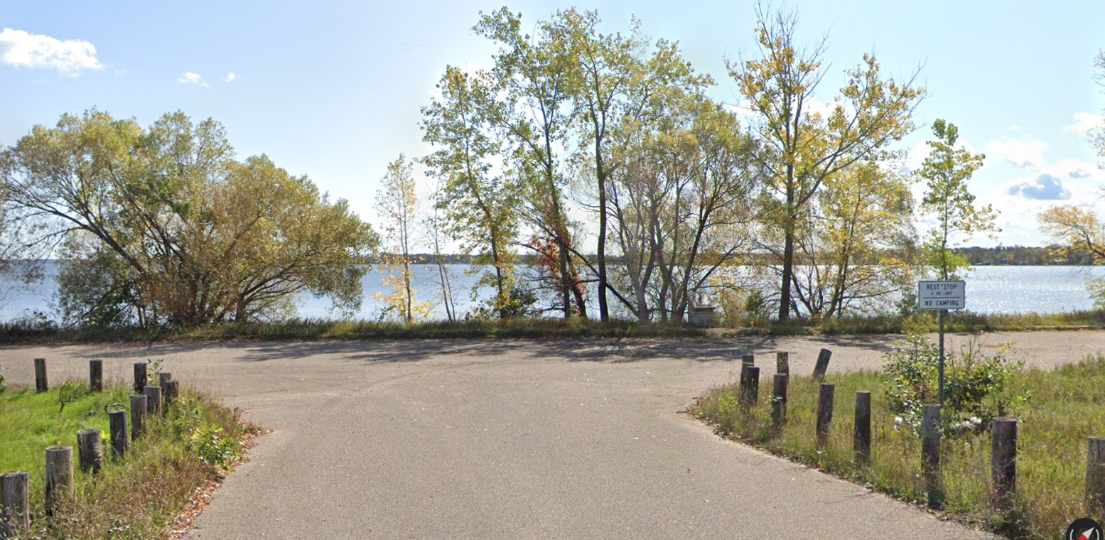
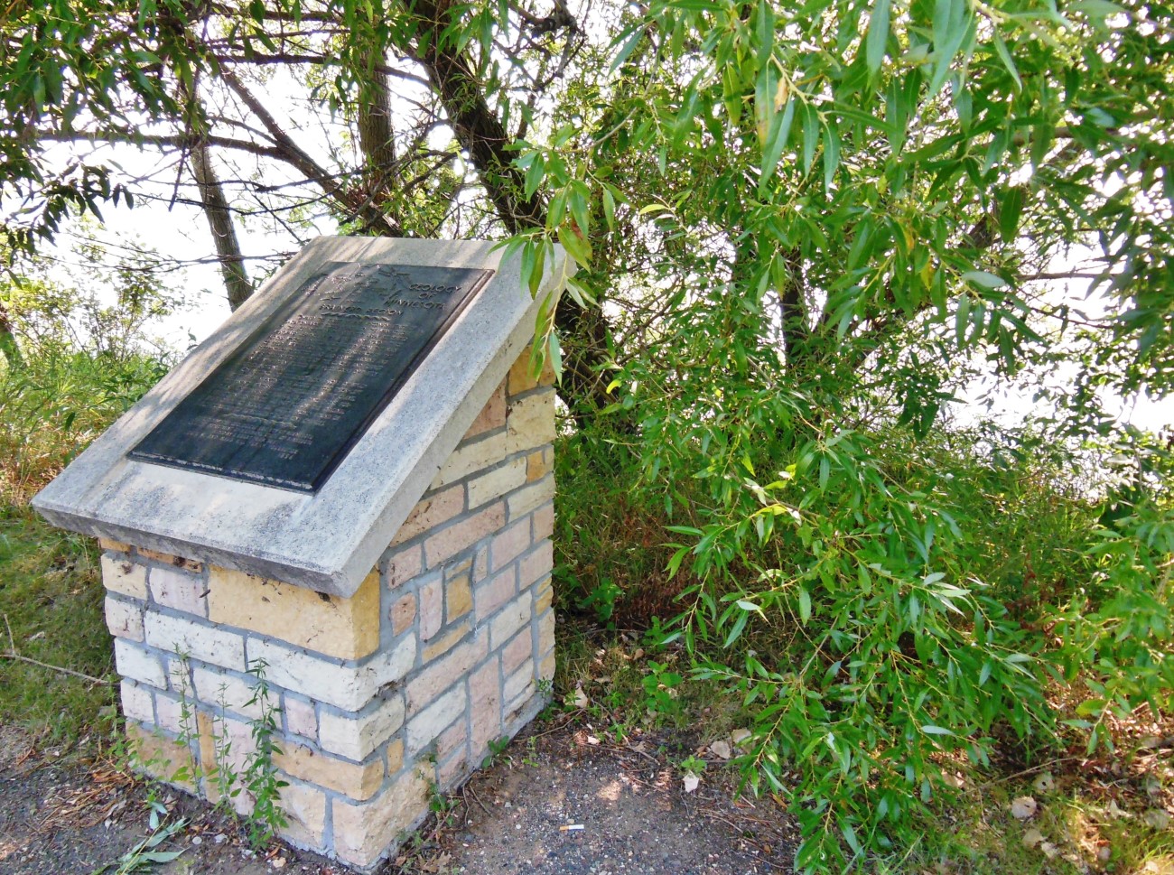
Marker is in Brainerd, Minnesota, in Crow Wing County. Marker is on State Highway 371, 0.1 miles north of Seagull Road Northwest, on the right when traveling north. Marker is located in a pull-out and parking area on the east side of the highway, overlooking North Long Lake.
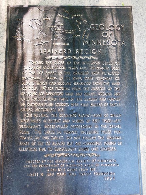
Marker Number:294 Marker Composition: Stone with Bronze plaques Text on Marker:
BRAINERD REGION
Toward the close of the Wisconsin stage of glaciation about 12,000 years ago, the waning lobe of the ice sheet in the Brainerd area retreated westward, leaving in its wake many stagnant ice blocks which had become separated from the main ice field. Water flowing from the surface of the receding ice deposited sand and gravel around and over these severed parts of the glacier and formed an outwash plain studded with huge blocks of partly buried, motionless ice. On melting, the detached blocks—some of which were miles in extent and scores of feet thick—left permanent, water-filled depressions in the gravel plain. The lakes so formed, including those portrayed on this tablet, do not follow the original shape of the ice blocks but are commonly round or elliptical due to subsequent shore line changes. Erected by the Geological Society of Minnesota and the Department of Highways, State of Minnesota aided by a grant from the Louis W. and Maud Hill Family Foundation. 1954
Region: North Central/West Region Date Updated: 6-12-25 Information Needed:
- Marker Images
Condition of Marker: Good Do it Yourself Region: Brainerd-Mille Lacs Verification: Patrick Steury
Description:
Enter Road Address in your cars GPS:
Brainerd Region Geological Marker, 19835 MN-371, Brainerd, MN 56401
OR
Enter Geographical Coordinates in your cars GPS:
Degrees Lat Long 46.4415315,-94.307247
Latitude 46°26’29.5″N
Longitude 94°18’16.8″W
Country: Crow Wing County
Where Found:
Marker is in Brainerd, Minnesota, in Crow Wing County. Marker is on State Highway 371, 0.1 miles north of Seagull Road Northwest, on the right when traveling north. Marker is located in a pull-out and parking area on the east side of the highway, overlooking North Long Lake.
Marker Number: 294
Marker Composition: Stone with Bronze plaques
Text on Marker:
BRAINERD REGION
Toward the close of the Wisconsin stage of glaciation about 12,000 years ago, the waning lobe of the ice sheet in the Brainerd area retreated westward, leaving in its wake many stagnant ice blocks which had become separated from the main ice field. Water flowing from the surface of the receding ice deposited sand and gravel around and over these severed parts of the glacier and formed an outwash plain studded with huge blocks of partly buried, motionless ice. On melting, the detached blocks—some of which were miles in extent and scores of feet thick—left permanent, water-filled depressions in the gravel plain. The lakes so formed, including those portrayed on this tablet, do not follow the original shape of the ice blocks but are commonly round or elliptical due to subsequent shore line changes. Erected by the Geological Society of Minnesota and the Department of Highways, State of Minnesota aided by a grant from the Louis W. and Maud Hill Family Foundation. 1954
Region: North Central/West Region
Date Updated: 6-12-25 Information Needed:
- Marker Images
Condition of Marker: Good
Do it Yourself Region: Brainerd-Mille Lacs
Verification: Patrick Steury