Road Marker Information
Enter Road Address in your cars GPS:
1200 Frontage Rd, Detroit Lakes, MN 56501
OR
Enter Geographical Coordinates in your cars GPS:
Degrees Lat Long: 46.803833,-95.811982
Latitude: 46°48’14.1″N
Longitude: 95°48’42.9″W
Country: Becker County
Where Found:
1240 US Hwy 10 East, about 1 mile southeast of Detroit Lakes in a wayside park on the shore of Detroit Lake
Marker Number:266
Marker Composition: Stone with Bronze plaques
Text on Marker:
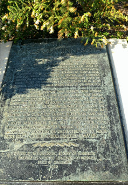
THE LAKES OF MINNESOTA
The great ice ages that began about one million years ago, were characterized by the advance and recession of huge ice sheets over vast areas of North America. These continental glaciers, originating in Canada, moved southward, scraping up mantle rock and soil which was dropped in central and southern Minnesota to produce plains and irregular belts of hills. Most of Minnesota’s 10,000 lakes lie in such deposits and trace their origin directly or indirectly to glaciation.
In the rugged surface that extends from Detroit Lakes to Alexandria, where glacial action was particularly vigorous, the lakes are irregular in outline. Elsewhere they may be round, long, wide, narrow, big, little, sun-warmed or ice-cold; shallow and sandy or rocky and deep; mucky and weed-fringed or clear as crystal; with or without islands, inlets, bays, sand bars, beaches, or cliffs. Taken together they give Minnesota a water area greater than that of any other state. Many exhibit landscapes of unusual beauty, but all, regardless of location or character, add to Minnesota’s most valuable mineral resource—water.
Erected by the Geological Society of Minnesota in cooperation with the Department of Highways, State of Minnesota. 1960
Region: North Central/West Region
Date Updated: 20160727
Information Needed:
- Marker Images
Condition of Marker: Fair
Do it Yourself Region: Northwest Corner
Verification: danjap7@yahoo.com

