Road Marker Information
Description:
More information about the marker.
Enter Road Address in your cars GPS:
MN-61, Grand Marais, MN 55604
OR
Enter Geographical Coordinates in your cars GPS:
Degrees Lat Long : 47.726226, -90.442477
Latitude: 47°43’51.8″N
Longitude: 90°26’22.4″W
Country: Cook County
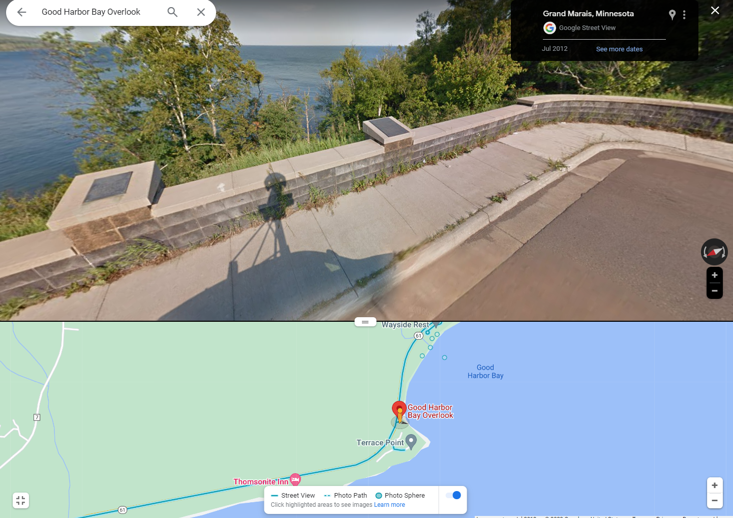
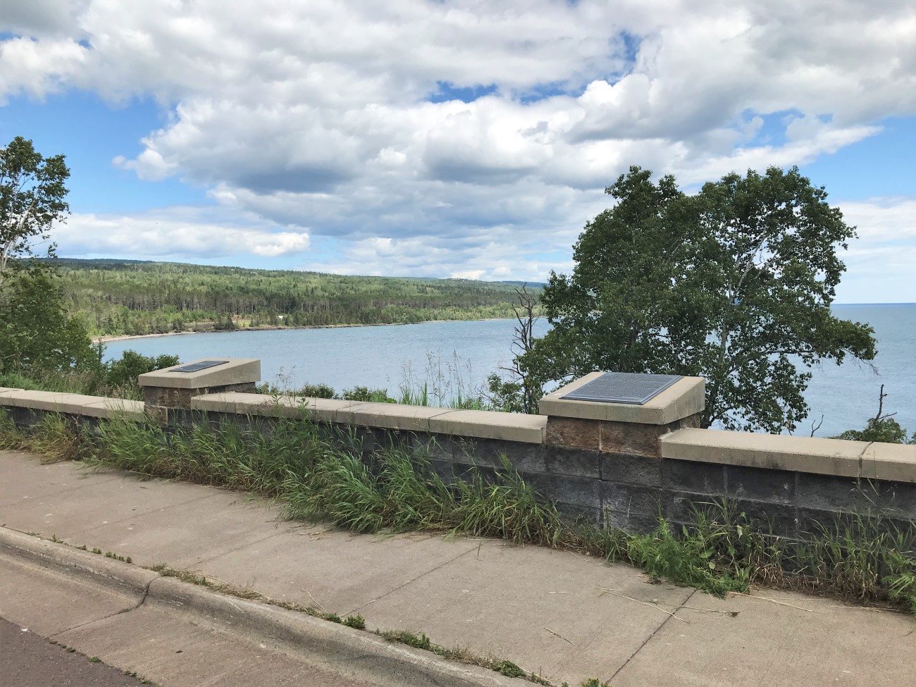
Where Found:
Located on state highway 61 about 5 miles southwest of Grand Marais
Marker Number:216
Marker Composition: Stone with Bronze plaques
Text on Marker:
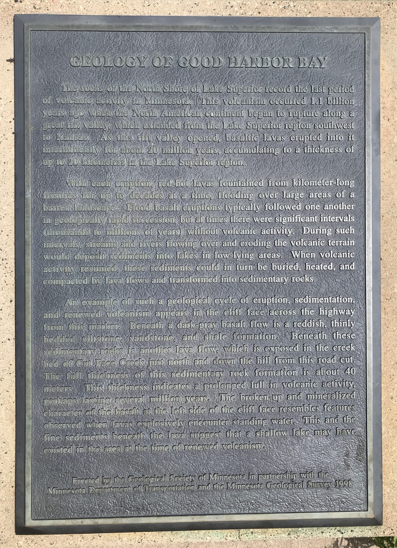
GOOD HARBOR BAY
The rocks of the North Shore of Lake Superior record the last period of volcanic activity in Minnesota. This volcanism occurred 1.1 billion years ago when the North American continent began to rupture along a great rift valley, which extended from the Lake Superior region southwest to Kansas. As this rift valley opened, basaltic lavas erupted into it intermittently for about 20 million years, accumulating to a thickness of up to 20 kilometers in the Lake Superior region. With each eruption, red-hot lavas fountained from kilometer-long fissures for up to decades aka time, flooding over large areas of a barren landscape. Flood basalt eruptions typically followed one another in geologically rapid succession, but at times there were significant intervals (thousands to millions of years) without volcanic activity. During such intervals, streams and rivers flowing over and eroding the volcanic terrain would deposit sediments into lakes in low-lying areas. When volcanic activity resumed, these sediments could in turn be buried, heated, and compacted by lava flows and transformed into sedimentary rocks. An example of such a geological cycle of eruption, sedimentation, and renewed volcanism appears in the cliff face across the highway from this marker. Beneath a dark-gray basalt flow is a reddish, thinly bedded silt-stone, sandstone and shale formation. Beneath these sedimentary rocks is another lava flow, which is exposed in the creek bed of Cut Face Creek just north and down the hill from this road cut. The full thickness of this sedimentary rock formation is about 40 meters. This thickness indicates a prolonged lull in volcanic activity, perhaps lasting several million years. The broken-up and mineralized character of the basalt at the left side of the cliff face resembles features observed when lavas explosively encounter standing water. This and the fine sediments beneath the lava suggest that a shallow lake may have existed in the area at the time of renewed volcanism.
Erected by the Geological Society of Minnesota in partnership with the Minnesota Department of Transportation and the Minnesota Geological Survey. 1998
Region: Northeast Region
Date Updated: 6-12-25
Information Needed:
- Marker Images
Condition of Marker: Good
Do it Yourself Region: North Shore
Verification: Patrick Steury